
चित्र:Tamil Nadu locator map-2010-29-10.svg

Size of this PNG preview of this SVG file: ४८४ × ५९९ पिक्सेल. इतर resolutions: १९४ × २४० पिक्सेल | ३८७ × ४८० पिक्सेल | ६२० × ७६८ पिक्सेल | ८२७ × १,०२४ पिक्सेल | १,६५४ × २,०४८ पिक्सेल | १,५९८ × १,९७९ पिक्सेल.
मूळ संचिका (SVG संचिका, साधारणपणे १,५९८ × १,९७९ pixels, संचिकेचा आकार: ४१२ कि.बा.)
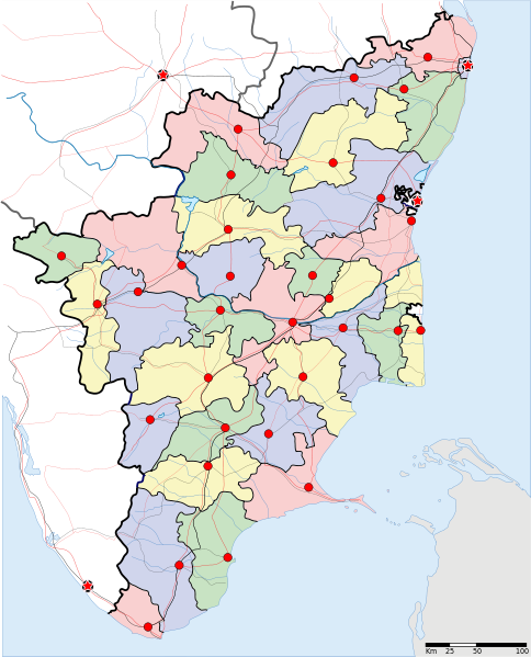
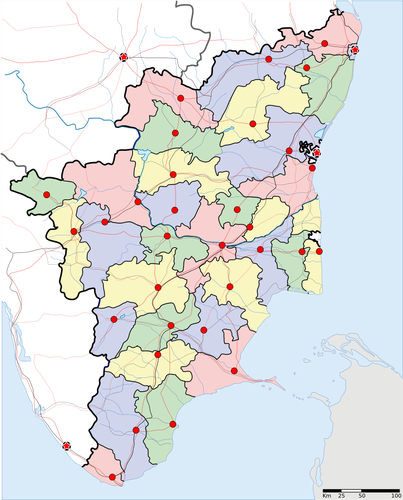
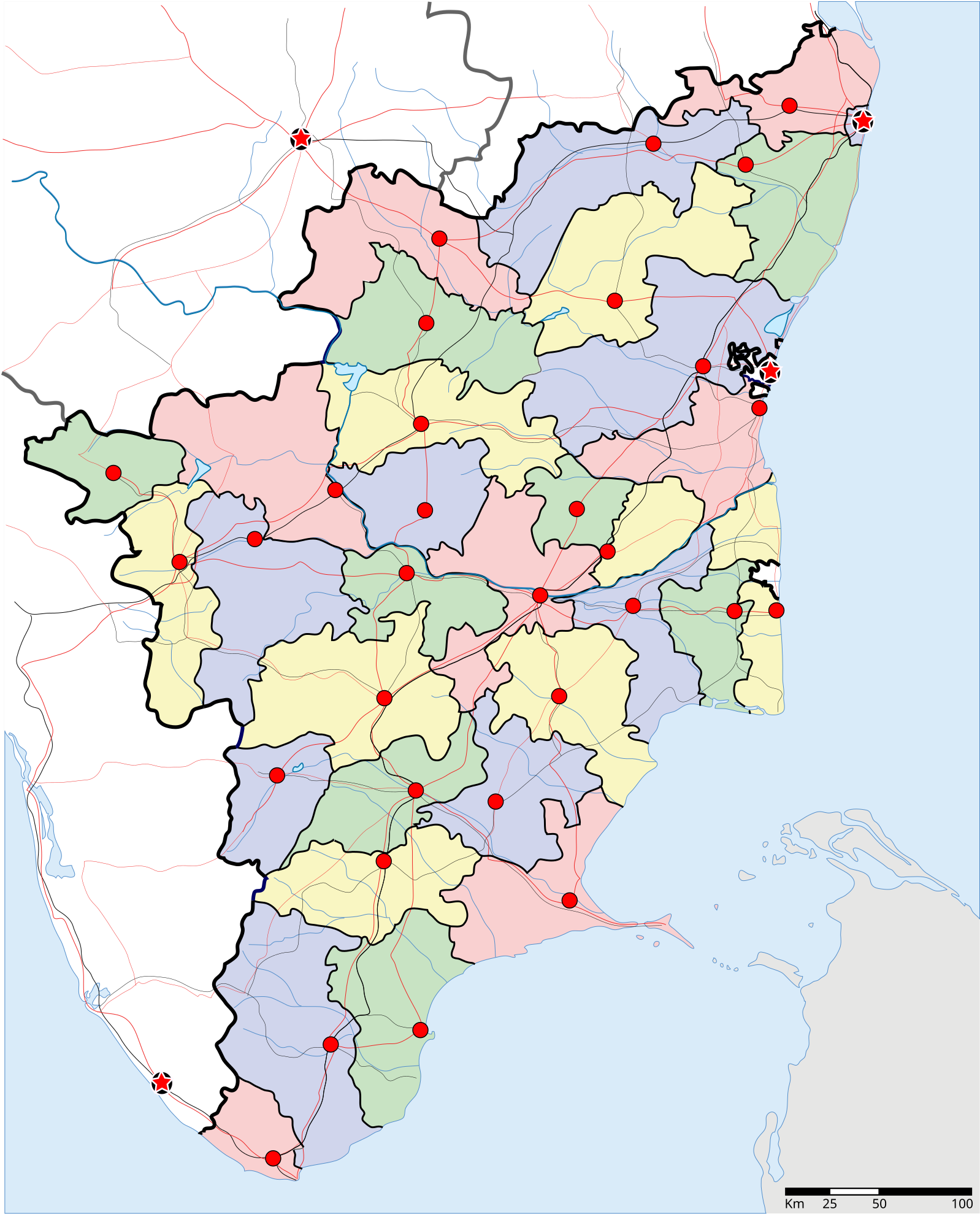
| वर्णन | Locator map of the state of Tamil Nadu, India with district boundaries |
| दिनांक | (UTC) |
| स्रोत | |
| लेखक |
|
| This is a retouched picture, which means that it has been digitally altered from its original version. Modifications: state name in tamil. The original can be viewed here: Tamil Nadu locator map.svg:
|
I, the copyright holder of this work, hereby publish it under the following license:
ही संचिका खालील परवान्याअंतर्गत आहे - क्रीएटिव्ह कॉमन्स Attribution-Share Alike 3.0 Unported.
- तुम्ही मुक्त आहात.
- सामायिक करा – नक्कल, वितरण आणि पारेषित करण्यास
- पुर्नमिश्रीत करण्यास – काम गरजेनुसार अनुकुलीत करण्यास
- खालील अटींच्या अधिन राहून:
- रोपण – आपण योग्य क्रेडिट देणे आवश्यक आहे, परवान्यास दुवा प्रदान करणे आवश्यक आहे, आणि बदल केले गेले आहेत हे दर्शविणे आवश्यक आहे. आपण हे कोणत्याही वाजवी मार्गाने करू शकता, परंतु परवानाधारक आपल्यास किंवा आपल्या वापरास मान्यता देतो अशा कोणत्याही मार्गाने नाही.
- जसेहोते-वाटातसेच (शेअर अलाईक) – जर तुम्ही या कामात काही बदल केलात, काटछाट केलीत, किंवा भर घातली, तर असे करून बनलेले नवीन काम तुम्ही केवळ या किंवा यासारख्याच परवान्याअंतर्गत प्रसारित करू शकतात.
चढवल्याचे मुळ विवरण
This image is a derivative work of the following images:
- File:Tamil_Nadu_locator_map.svg licensed with Cc-by-sa-3.0
- 2007-04-02T10:30:42Z Planemad 1591x1975 (121634 Bytes) {{WikiProject_India_Maps |Title=Tamil Nadu locator map |Description=Locator map of the state of Tamil Nadu, [[w:India|India]] with district boundaries |Source=. |Date=2 April 2007 |Author=[[w:user:Planemad]] }} [[Category:Wi
Uploaded with derivativeFX
संचिकेचा इतिहास
संचिकेची त्यावेळची आवृत्ती बघण्यासाठी त्या दिनांक/वेळेवर टिचकी द्या.
| दिनांक/वेळ | छोटे चित्र | आकार | सदस्य | प्रतिक्रीया | |
|---|---|---|---|---|---|
| सद्य | ११:०९, २९ ऑक्टोबर २०१० | | १,५९८ × १,९७९ (४१२ कि.बा.) | Wikimed78 | {{Information |Description=Locator map of the state of Tamil Nadu, India with district boundaries |Source=*File:Tamil_Nadu_locator_map.svg |Date=2010-10-29 05:37 (UTC) |Author=*File:Tamil_Nadu_locator_map.svg: '''with Ariyalur dist |
| १०:५२, २९ ऑक्टोबर २०१० |  | १,५९८ × १,९७९ (४२४ कि.बा.) | Wikimed78 | {{Information |Description=Locator map of the state of Tamil Nadu, India with district boundaries |Source=*File:Tamil_Nadu_locator_map.svg |Date=2010-10-29 05:21 (UTC) |Author=*File:Tamil_Nadu_locator_map.svg: '''State name in tami | |
| १०:३६, २९ ऑक्टोबर २०१० |  | ७४४ × १,०५२ (४२० कि.बा.) | Wikimed78 | {{Information |Description=Locator map of the state of Tamil Nadu, India with district boundaries |Source=*File:Tamil_Nadu_locator_map.svg |Date=2010-10-29 05:04 (UTC) |Author=*File:Tamil_Nadu_locator_map.svg: '''state name in tami | |
| १०:०९, २९ ऑक्टोबर २०१० |  | ७४४ × १,०५२ (४२० कि.बा.) | Wikimed78 | {{Information |Description=Locator map of the state of Tamil Nadu, India with district boundaries |Source=*File:Tamil_Nadu_locator_map.svg |Date=2010-10-29 04:36 (UTC) |Author=*File:Tamil_Nadu_locator_map.svg: '''state name in tami |
दुवे
खालील पाने या संचिकेला जोडली आहेत:
- अरक्कोणम नौसेना तळ
- आनैमलाई पर्वतरांग
- इरोड
- इरोड जिल्हा
- उदगमंडलम
- एम. करुणानिधी
- एम.जी. रामचंद्रन
- कडलूर
- कन्याकुमारी
- कन्याकुमारी जिल्हा
- करुर जिल्हा
- कांचीपुरम
- कांचीपुरम जिल्हा
- कुंभकोणम
- कोइंबतूर
- चेंगलपट्टू
- चेन्नई
- चेन्नई जिल्हा
- चोळपुरम
- तंजावूर
- तंजावूर मराठा राज्य
- तंजावूर वायुसेना तळ
- तमिळ चलचित्रपट
- तमिळ लोक
- तमिळनाडू
- तिरुचिरापल्ली
- तिरुचिरापल्ली जिल्हा
- तिरुचिरापल्ली रॉकफोर्ट
- तिरुनलवेली
- तिरुनलवेली जिल्हा
- तिरुवनमलाई
- तिरुवरुर
- तिरुवरुर जिल्हा
- तिरुवल्लूर
- तिरुवल्लूर जिल्हा
- तूतुकुडी
- तूतुकुडी जिल्हा
- तेनकाशी
- तेनी
- तेनी जिल्हा
- धर्मपुरी
- धर्मपुरी जिल्हा
- नागपट्टिनम जिल्हा
- नागरकोविल
- निलगिरी जिल्हा
- पलानी
- पालक्काड खिंड
- पाल्क सामुद्रधुनी
- पेराम्बलुर
- पेराम्बलुर जिल्हा
- पोल्लाची
- फोर्ट सेंट जॉर्ज, चेन्नई
- फोर्ट सेंट डेव्हिड, कडलूर
- मदुराई जिल्हा
- मयिलापूर
- महाबलिपुरम
- रामनाथपुरम
- लिबरेशन टायगर्स ऑफ तमिळ ईलम
- विरुधुनगर
- विरुधुनगर जिल्हा
- विलुपुरम
- विलुपुरम जिल्हा
- वेल्लूर विमानतळ
- शिवकाशी
- शिवगंगा
- शिवगंगा जिल्हा
- शुद्ध तमिळ चळवळ
- श्रीपेरुम्बुदुर
- सी.एन. अण्णादुराई
- सुलुर वायुसेना तळ
- सेलम
- सेलम जिल्हा
- सेलम विमानतळ
- स्वाभिमान चळवळ
- होसूर
- साचा:तमिळनाडू राज्य