
चित्र:USA location map.svg

Size of this PNG preview of this SVG file: ८०० × ४१७ पिक्सेल. इतर resolutions: ३२० × १६७ पिक्सेल | ६४० × ३३३ पिक्सेल | १,०२४ × ५३३ पिक्सेल | १,२८० × ६६७ पिक्सेल | २,५६० × १,३३३ पिक्सेल | १,८५९ × ९६८ पिक्सेल.
मूळ संचिका (SVG संचिका, साधारणपणे १,८५९ × ९६८ pixels, संचिकेचा आकार: ७२१ कि.बा.)
सारांश
| वर्णन |
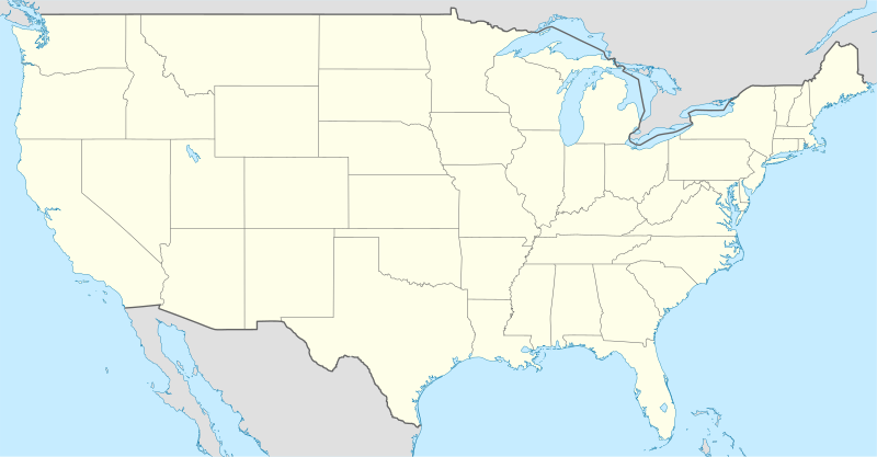
Deutsch: Positionskarte der Vereinigten Staaten („lower 48“)
Quadratische Plattkarte, N-S-Streckung 120 %. Geographische Begrenzung der Karte:
English: Location map of the United States ("lower 48")
Equirectangular projection, N/S stretching 120 %. Geographic limits of the map:
Italiano: Mappa di localizzazione degli Stati Uniti d'America ("lower 48")
Proiezione equirettangolare, stiramento N/S 120 %. Limiti geografici della mappa:
|
| दिनांक | |
| स्रोत |
own work, using
|
| लेखक | NordNordWest |
| इतर आवृत्तींस |
Derivative works of this file: |

|
This map has been made or improved in the German Kartenwerkstatt (Map Lab). You can propose maps to improve as well.
|
परवाना:
मी, या कामाचा/कामाची परवानाधारक, खालील परवान्यांअंतर्गत हे काम येथे प्रकाशित करत आहे :

|
फ्री सॉफ्टवेअर फाऊंडेशन द्वारे प्रकाशित जीएनयू मुक्त दस्ताऐवजीकरण परवाना, आवृत्ती १.२ किंवा त्यानंतरची,या अंतर्गत; या दस्तावेजास, नकलविण्याची, वितरणाची व/किंवा फेरबदलाची परवानगी दिल्या जाते या अटींसह कि त्यात कोणतेही निश्चलित(Invariant) विभाग नकोत,पृष्टपान मजकूर नको व मलपान मजकूर नको. GNU Free Documentation License हा मथळा असलेल्या विभागात,या परवान्याची प्रत अंतर्भूत केलेली आहे. |
ही संचिका खालील परवान्याअंतर्गत आहे - क्रीएटिव्ह कॉमन्स Attribution-Share Alike 3.0 Unported.
- तुम्ही मुक्त आहात.
- सामायिक करा – नक्कल, वितरण आणि पारेषित करण्यास
- पुर्नमिश्रीत करण्यास – काम गरजेनुसार अनुकुलीत करण्यास
- खालील अटींच्या अधिन राहून:
- रोपण – आपण योग्य क्रेडिट देणे आवश्यक आहे, परवान्यास दुवा प्रदान करणे आवश्यक आहे, आणि बदल केले गेले आहेत हे दर्शविणे आवश्यक आहे. आपण हे कोणत्याही वाजवी मार्गाने करू शकता, परंतु परवानाधारक आपल्यास किंवा आपल्या वापरास मान्यता देतो अशा कोणत्याही मार्गाने नाही.
- जसेहोते-वाटातसेच (शेअर अलाईक) – जर तुम्ही या कामात काही बदल केलात, काटछाट केलीत, किंवा भर घातली, तर असे करून बनलेले नवीन काम तुम्ही केवळ या किंवा यासारख्याच परवान्याअंतर्गत प्रसारित करू शकतात.
तुमच्या पसंतीचा परवाना तुम्ही निवडू शकता.
संचिकेचा इतिहास
संचिकेची त्यावेळची आवृत्ती बघण्यासाठी त्या दिनांक/वेळेवर टिचकी द्या.
| दिनांक/वेळ | छोटे चित्र | आकार | सदस्य | प्रतिक्रीया | |
|---|---|---|---|---|---|
| सद्य | ०१:३४, ३० जुलै २००८ | | १,८५९ × ९६८ (७२१ कि.बा.) | NordNordWest | {{Information |Description= {{de|Positionskarte der Vereinigten Staaten}} Quadratische Plattkarte, N-S-Streckung 120 %. Geographische Begrenzung der Karte: * N: 49.8° N * S: 24.2° N * W: 125.5° W * O: 66.5° W {{en|Location m |
दुवे
या संचिके ला १०० पाने जोडली आहेत. खालील यादी या संचिके ला जोडलेल्या पहिल्या १०० पानांचे दुवेदर्शविते. संपुर्ण यादी उपलब्ध आहे.
- अटलांटा
- आमारियो (टेक्सास)
- आयोवा सिटी (आयोवा)
- आल्बनी (न्यू यॉर्क)
- आल्बुकर्की (न्यू मेक्सिको)
- इंडियानापोलिस
- ईगन (मिनेसोटा)
- ऑस्टिन (टेक्सास)
- ओक्लाहोमा सिटी
- ओमाहा (नेब्रास्का)
- ओरलँडो (फ्लोरिडा)
- काउन्सिल ब्लफ्स (आयोवा)
- कार्सन सिटी (नेव्हाडा)
- कॅन्सस सिटी (मिसूरी)
- कॅम्डेन (न्यू जर्सी)
- कॉर्पस क्रिस्टी (टेक्सास)
- कॉलोराडो स्प्रिंग्ज (कॉलोराडो)
- कोलंबस (ओहायो)
- कोलंबिया (साउथ कॅरोलिना)
- क्लीव्हलँड
- गॅल्व्हस्टन (टेक्सास)
- ग्रीन बे (विस्कॉन्सिन)
- चार्ल्स सिटी (आयोवा)
- चॅटानूगा (टेनेसी)
- जॅक्सनव्हिल (फ्लोरिडा)
- जेफरसन सिटी (मिसूरी)
- जॉन्सटाउन (पेनसिल्व्हेनिया)
- टँपा (फ्लोरिडा)
- टल्सा (ओक्लाहोमा)
- टॅलाहासी (फ्लोरिडा)
- टोपेका (कॅन्सस)
- ट्रेंटन (न्यू जर्सी)
- डॅलस
- डॅव्हेनपोर्ट (आयोवा)
- डेटन (केंटकी)
- डेट्रॉईट
- डेन्व्हर
- तुसॉन (अॅरिझोना)
- दे मॉईन (आयोवा)
- नॅशव्हिल (टेनेसी)
- न्यू ऑर्लिन्स
- न्यू यॉर्क सिटी
- पिएर (साउथ डकोटा)
- पिट्सबर्ग
- पेन्साकोला (फ्लोरिडा)
- पेब्लो (कॉलोराडो)
- पोर्टलंड (ओरेगन)
- फिलाडेल्फिया
- फोर्ट लॉडरडेल (फ्लोरिडा)
- फोर्ट वर्थ (टेक्सास)
- फ्रँकफोर्ट (केंटकी)
- फ्रेस्नो (कॅलिफोर्निया)
- बफेलो (न्यू यॉर्क)
- बाल्टिमोर
- बिलिंग्स (माँटाना)
- बॅटन रूज
- बेट्टेनडॉर्फ (आयोवा)
- बॉइझी (आयडाहो)
- बॉस्टन
- बोल्डर (कॉलोराडो)
- माँटगोमेरी (अलाबामा)
- माँटेरे (कॅलिफोर्निया)
- माँतपेलिए (व्हरमाँट)
- मिनीयापोलिस
- मिलवॉकी
- मॅडिसन (विस्कॉन्सिन)
- मेसन सिटी (आयोवा)
- रिचमंड (व्हर्जिनिया)
- रिनो (नेव्हाडा)
- रॅले (नॉर्थ कॅरोलिना)
- लबक (टेक्सास)
- लान्सिंग (मिशिगन)
- लास व्हेगस
- लिंकन (नेब्रास्का)
- लिटल रॉक (आर्कान्सा)
- लुईव्हिल (केंटकी)
- विचिटा (कॅन्सस)
- वॉटर्लू (आयोवा)
- शार्लट (नॉर्थ कॅरोलिना)
- शिकागो
- सव्हाना (जॉर्जिया)
- सांता फे (न्यू मेक्सिको)
- सिअॅटल
- सिनसिनाटी
- सीडार रॅपिड्स (आयोवा)
- सू सिटी (आयोवा)
- सॅक्रामेंटो (कॅलिफोर्निया)
- सॅन अँटोनियो
- सॅन फ्रान्सिस्को
- सेंट पीटर्सबर्ग (फ्लोरिडा)
- सेंट पॉल (मिनेसोटा)
- सेंट लुईस (मिसूरी)
- सॉल्ट लेक सिटी
- स्प्रिंगफील्ड (इलिनॉय)
- हार्टफर्ड (कनेटिकट)
- हॅरिसबर्ग (पेनसिल्व्हेनिया)
- ह्युस्टन
- १९९४ फिफा विश्वचषक
- ॲनापोलिस (मेरीलँड)
- साचा:Location map+
या संचिकेचे अधिक दुवे पहा.
जागतिक संचिका उपयोग
संचिकाचे इतर विकिपीडियावरील वापरः
- af.wikipedia.org वरील उपयोग
- am.wikipedia.org वरील उपयोग
- ar.wikipedia.org वरील उपयोग
- arz.wikipedia.org वरील उपयोग
- as.wikipedia.org वरील उपयोग
- azb.wikipedia.org वरील उपयोग
- be-tarask.wikipedia.org वरील उपयोग
- Саўт-Рывэр
- Нью-Ёрк
- Вашынгтон (акруга Калюмбія)
- Чыкага
- Лос-Анджэлес
- Лас-Вэгас
- Пітсбург (Пэнсыльванія)
- Філадэлфія
- Сіетл
- Г’юстан
- Далас
- Фінікс (Арызона)
- Сан-Антоніё
- Сан-Дыега
- Дэтройт
- Сан-Хасэ (Каліфорнія)
- Індыянапаліс
- Джэксанвіль
- Каламбус
- Калюмбійскі ўнівэрсытэт
- Рэдынг (Пэнсыльванія)
- Тэрарыстычныя акты 11 верасьня 2001 году
- Маўнтын-Вію (Каліфорнія)
- Мэнла-Парк (Каліфорнія)
या संचिकेचे अधिक वैश्विक उपयोग पहा