
चित्र:Java location map plain.svg

Size of this PNG preview of this SVG file: ८०० × ३६२ पिक्सेल. इतर resolutions: ३२० × १४५ पिक्सेल | ६४० × २९० पिक्सेल | १,०२४ × ४६४ पिक्सेल | १,२८० × ५७९ पिक्सेल | २,५६० × १,१५९ पिक्सेल | १,१५३ × ५२२ पिक्सेल.
मूळ संचिका (SVG संचिका, साधारणपणे १,१५३ × ५२२ pixels, संचिकेचा आकार: १.९९ मे.बा.)
सारांश
| वर्णन |
|
|||||||||
| SVG Development | This W3C-unspecified vector image was created with QGIS. This W3C-unspecified vector image was created with Inkscape . |
|||||||||
| दिनांक | ||||||||||
| स्रोत |
Bahasa Indonesia: Karya sendiri berdasarkan sumber;
Sunda: Beunang sorangan dumasar tina sumber;
English: Own work based on sources;
|
|||||||||
| रचनाकार | ||||||||||
| Geotemporal data | ||||||||||
| Spatial reference system | Equirectangular | |||||||||
| Heading |
 |
|||||||||
| Bounding box |
|
|||||||||
| इतर आवृत्तींस |
|
|||||||||

परवाना:
I, the copyright holder of this work, hereby publish it under the following license:
This file is licensed under the Creative Commons Attribution-Share Alike 4.0 International license.
रोपण: RXerself/Wikimedia Commons/CC BY-SA 4.0
- तुम्ही मुक्त आहात.
- सामायिक करा – नक्कल, वितरण आणि पारेषित करण्यास
- पुर्नमिश्रीत करण्यास – काम गरजेनुसार अनुकुलीत करण्यास
- खालील अटींच्या अधिन राहून:
- रोपण – आपण योग्य क्रेडिट देणे आवश्यक आहे, परवान्यास दुवा प्रदान करणे आवश्यक आहे, आणि बदल केले गेले आहेत हे दर्शविणे आवश्यक आहे. आपण हे कोणत्याही वाजवी मार्गाने करू शकता, परंतु परवानाधारक आपल्यास किंवा आपल्या वापरास मान्यता देतो अशा कोणत्याही मार्गाने नाही.
- जसेहोते-वाटातसेच (शेअर अलाईक) – जर तुम्ही या कामात काही बदल केलात, काटछाट केलीत, किंवा भर घातली, तर असे करून बनलेले नवीन काम तुम्ही केवळ या किंवा यासारख्याच परवान्याअंतर्गत प्रसारित करू शकतात.
संचिकेचा इतिहास
संचिकेची त्यावेळची आवृत्ती बघण्यासाठी त्या दिनांक/वेळेवर टिचकी द्या.
| दिनांक/वेळ | छोटे चित्र | आकार | सदस्य | प्रतिक्रीया | |
|---|---|---|---|---|---|
| सद्य | ०३:३९, १० सप्टेंबर २०२२ | | १,१५३ × ५२२ (१.९९ मे.बा.) | RXerself | extent, rivers |
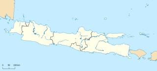
| १०:०४, २७ ऑगस्ट २०२२ | १,१५३ × ३९९ (२.११ मे.बा.) | RXerself | == {{int:filedesc}} == {{Map |Description= * {{id|Peta Pulau {{W|Jawa||id}} untuk skema peta lokasi dengan batas administratif serta pulau-pulau di sekitarnya yang termasuk dalam provinsi yang ada di Jawa. Saya tidak menyertakan batas provinsi di laut karena tidak ada sumber resmi yang saya dapat temukan.}} * {{en|Plain map of {{W|Java}} for the location map scheme with administrative borders and surrounding islands belonged to the provinces in the island. I did not add maritime borders for t... |
दुवे
खालील पाने या संचिकेला जोडली आहेत:
जागतिक संचिका उपयोग
संचिकाचे इतर विकिपीडियावरील वापरः
- en.wikipedia.org वरील उपयोग
- Jakarta
- Surabaya
- Borobudur
- Bandung
- Banyuwangi Regency
- Surakarta
- Prambanan
- Depok
- Batu, East Java
- Cirebon
- Cianjur
- Bogor
- Semarang
- Soekarno–Hatta International Airport
- Garut Regency
- Malang
- Tangerang
- Bojonegoro Regency
- Majalengka
- Bekasi
- Banyumas Regency
- Cilacap Regency
- Magelang
- Cilegon
- Jombang Regency
- Tasikmalaya
- Probolinggo
- Tegal
- Adisutjipto Airport
- Sukabumi
- Kalasan
- Pasuruan
- Bandung Regency
- Pekalongan
- Cimahi
- Kuningan
- Adisumarmo Airport
- Nusa Kambangan
- Kotagede
- Cinere
- Bondowoso Regency
- Madiun
- Sijeruk
- Wonosobo Regency
- Pemalang Regency
- Mojokerto
- Gelora 10 November Stadium
- Salatiga
- Villa Isola
- Bantul Regency
या संचिकेचे अधिक वैश्विक उपयोग पहा