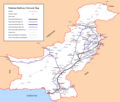
चित्र:Pakistan Railways Network Map.png
Appearance

या झलकेचा आकार: ७०७ × ६०० पिक्सेल पिक्सेल. इतर resolutions: २८३ × २४० पिक्सेल | ५६६ × ४८० पिक्सेल | ९०५ × ७६८ पिक्सेल | १,२०७ × १,०२४ पिक्सेल | २,४१४ × २,०४८ पिक्सेल | ३,०५९ × २,५९५ पिक्सेल.
मूळ संचिका (३,०५९ × २,५९५ पिक्सेल, संचिकेचा आकार: ६४८ कि.बा., MIME प्रकार: image/png)
संचिकेचा इतिहास
संचिकेची त्यावेळची आवृत्ती बघण्यासाठी त्या दिनांक/वेळेवर टिचकी द्या.
| दिनांक/वेळ | छोटे चित्र | आकार | सदस्य | प्रतिक्रीया | |
|---|---|---|---|---|---|
| सद्य | २३:१९, ३ सप्टेंबर २०१६ |  | ३,०५९ × २,५९५ (६४८ कि.बा.) | Adnanleon | Updated Karachi-Lahore dual railway track, Added Karachi-Gwadar, Islamabad-Muzaffarabad and Basima-Jacobabad proposed railway lines. |
| १७:१४, २७ जानेवारी २०१४ |  | ३,०३२ × २,५७२ (५९१ कि.बा.) | RaviC | + Jammu link | |
| ०२:२४, १ ऑगस्ट २०१३ |  | ३,०३२ × २,५७२ (६२८ कि.बा.) | Adnanleon | Fill white color in center | |
| ०१:५७, १ ऑगस्ट २०१३ |  | ३,०३२ × २,५७२ (५६० कि.बा.) | Adnanleon | Correction in Sahiwal-Raiwind section and Pak-China proposed railway line | |
| १३:५७, १ मार्च २०१२ |  | ३,०४२ × २,५५७ (५१७ कि.बा.) | Nomi887 | Added colour (reason: to make map prominent) | |
| ०३:५१, २९ फेब्रुवारी २०१२ |  | ३,०४२ × २,५५७ (५८५ कि.बा.) | Sven Manguard | Removing time and author from image. This is *NOT* the version sent by OTRS, that one is immediately below. | |
| ०३:४२, २९ फेब्रुवारी २०१२ |  | ३,०४२ × २,५५७ (५९५ कि.बा.) | Sven Manguard | Update sent via OTRS photosubmissions | |
| ००:२५, २३ नोव्हेंबर २०११ |  | ३,०१० × २,५४० (४६६ कि.बा.) | Adnanleon |
दुवे
खालील पाने या संचिकेला जोडली आहेत:
जागतिक संचिका उपयोग
संचिकाचे इतर विकिपीडियावरील वापरः
- bn.wikipedia.org वरील उपयोग
- de.wikipedia.org वरील उपयोग
- de.wikivoyage.org वरील उपयोग
- en.wikipedia.org वरील उपयोग
- en.wikivoyage.org वरील उपयोग
- eo.wikipedia.org वरील उपयोग
- fr.wikipedia.org वरील उपयोग
- hi.wikipedia.org वरील उपयोग
- hu.wikipedia.org वरील उपयोग
- it.wikivoyage.org वरील उपयोग
- ja.wikipedia.org वरील उपयोग
- pl.wikipedia.org वरील उपयोग
- pnb.wikipedia.org वरील उपयोग
या संचिकेचे अधिक वैश्विक उपयोग पहा
