
चित्र:Antarctica, Australia territorial claim.svg

Size of this PNG preview of this SVG file: ६०० × ६०० पिक्सेल. इतर resolutions: २४० × २४० पिक्सेल | ४८० × ४८० पिक्सेल | ७६८ × ७६८ पिक्सेल | १,०२४ × १,०२४ पिक्सेल | २,०४८ × २,०४८ पिक्सेल | ८०६ × ८०६ पिक्सेल.
मूळ संचिका (SVG संचिका, साधारणपणे ८०६ × ८०६ pixels, संचिकेचा आकार: ६३ कि.बा.)
| वर्णन |
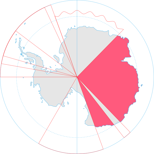
English: Map showing the territorial claim to Antarctica by the country in the filename. Also on the map are is the 60° S Parallel, Antarctic Circle, 0/180 latitude line and (in red) the borders of the claims by other states. |
| दिनांक | |
| स्रोत | Generated from Antarctica by Lokal_Profil. |
| लेखक | Lokal_Profil |
| परवानगी (या संचिकेचा पुनर्वापर करीत आहे) |
ही संचिका खालील परवान्याअंतर्गत आहे - क्रीएटिव्ह कॉमन्स Attribution-Share Alike 2.5 Generic. रोपण: Lokal_Profil
|
संचिकेचा इतिहास
संचिकेची त्यावेळची आवृत्ती बघण्यासाठी त्या दिनांक/वेळेवर टिचकी द्या.
| दिनांक/वेळ | छोटे चित्र | आकार | सदस्य | प्रतिक्रीया | |
|---|---|---|---|---|---|
| सद्य | २२:३१, ८ मे २०२० | | ८०६ × ८०६ (६३ कि.बा.) | Spesh531 | Norway's claim extends south to the South Pole as of June 12 2015. Northern claim is still undefined |
| ०२:२५, १ जुलै २००८ |  | ८०६ × ८०६ (६५ कि.बा.) | Lokal Profil | {{Information |Description={{en|Map showing the territorial claim to Antarctica by the country in the filename. Also on the map are is the 60° S Parallel, Antarctic Circle, 0/180 latitude line and (in red) the borders of the claims by other states.}} |So |
दुवे
खालील पाने या संचिकेला जोडली आहेत:
जागतिक संचिका उपयोग
संचिकाचे इतर विकिपीडियावरील वापरः
- af.wikipedia.org वरील उपयोग
- an.wikipedia.org वरील उपयोग
- ar.wikipedia.org वरील उपयोग
- az.wikipedia.org वरील उपयोग
- bg.wikipedia.org वरील उपयोग
- br.wikipedia.org वरील उपयोग
- ca.wikipedia.org वरील उपयोग
- chr.wikipedia.org वरील उपयोग
- ckb.wikipedia.org वरील उपयोग
- cs.wikipedia.org वरील उपयोग
- de.wikipedia.org वरील उपयोग
- diq.wikipedia.org वरील उपयोग
- el.wikipedia.org वरील उपयोग
- en.wikipedia.org वरील उपयोग
- et.wikipedia.org वरील उपयोग
- fa.wikipedia.org वरील उपयोग
- fi.wikipedia.org वरील उपयोग
- frr.wikipedia.org वरील उपयोग
- fr.wikipedia.org वरील उपयोग
- fy.wikipedia.org वरील उपयोग
- gl.wikipedia.org वरील उपयोग
- gv.wikipedia.org वरील उपयोग
- hu.wikipedia.org वरील उपयोग
- id.wikipedia.org वरील उपयोग
- ilo.wikipedia.org वरील उपयोग
या संचिकेचे अधिक वैश्विक उपयोग पहा