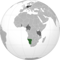
चित्र:German sw africa map.png
Appearance

या झलकेचा आकार: ६०० × ६०० पिक्सेल पिक्सेल. इतर resolutions: २४० × २४० पिक्सेल | ४८० × ४८० पिक्सेल | ७६८ × ७६८ पिक्सेल | १,०२४ × १,०२४ पिक्सेल | २,००० × २,००० पिक्सेल.
मूळ संचिका (२,००० × २,००० पिक्सेल, संचिकेचा आकार: ६०२ कि.बा., MIME प्रकार: image/png)
संचिकेचा इतिहास
संचिकेची त्यावेळची आवृत्ती बघण्यासाठी त्या दिनांक/वेळेवर टिचकी द्या.
| दिनांक/वेळ | छोटे चित्र | आकार | सदस्य | प्रतिक्रीया | |
|---|---|---|---|---|---|
| सद्य | २१:१६, १० फेब्रुवारी २०२३ |  | २,००० × २,००० (६०२ कि.बा.) | Goran tek-en | Added border of South Sudan as requested by Maphobbyist |
| २१:००, ६ एप्रिल २०१३ |  | २,००० × २,००० (५९६ कि.बा.) | OgreBot | (BOT): Reverting to most recent version before archival | |
| २१:००, ६ एप्रिल २०१३ |  | २,००० × २,००० (५९६ कि.बा.) | OgreBot | (BOT): Uploading old version of file from en.wikipedia; originally uploaded on 2010-06-02 20:50:38 by VoodooIsland | |
| २१:००, ६ एप्रिल २०१३ |  | २,००० × २,००० (५९५ कि.बा.) | OgreBot | (BOT): Uploading old version of file from en.wikipedia; originally uploaded on 2010-06-02 20:49:01 by VoodooIsland | |
| १६:४४, ५ एप्रिल २०१३ |  | २,००० × २,००० (५९६ कि.बा.) | File Upload Bot (Magnus Manske) | Transfered from en.wikipedia by User:misha motsniy using CommonsHelper |
दुवे
खालील पाने या संचिकेला जोडली आहेत:
जागतिक संचिका उपयोग
संचिकाचे इतर विकिपीडियावरील वापरः
- af.wikipedia.org वरील उपयोग
- ar.wikipedia.org वरील उपयोग
- ast.wikipedia.org वरील उपयोग
- az.wikipedia.org वरील उपयोग
- be.wikipedia.org वरील उपयोग
- ca.wikipedia.org वरील उपयोग
- cs.wikipedia.org वरील उपयोग
- el.wikipedia.org वरील उपयोग
- he.wikipedia.org वरील उपयोग
- hi.wikipedia.org वरील उपयोग
- it.wikipedia.org वरील उपयोग
- li.wikipedia.org वरील उपयोग
- lt.wikipedia.org वरील उपयोग
- nl.wikipedia.org वरील उपयोग
- simple.wikipedia.org वरील उपयोग
- uk.wikipedia.org वरील उपयोग
- ur.wikipedia.org वरील उपयोग
- vi.wikipedia.org वरील उपयोग
- www.wikidata.org वरील उपयोग
