
चित्र:TokyoMapCurrent.png

या झलकेचा आकार: ८०० × ४०० पिक्सेल पिक्सेल. इतर resolutions: ३२० × १६० पिक्सेल | ६४० × ३२० पिक्सेल | १,२८० × ६४० पिक्सेल.
मूळ संचिका (१,२८० × ६४० पिक्सेल, संचिकेचा आकार: ५४ कि.बा., MIME प्रकार: image/png)

|
File:TokyoMap.svg is a vector version of this file. It should be used in place of this PNG file.
File:TokyoMapCurrent.png → File:TokyoMap.svg
For more information, see Help:SVG. |
 |
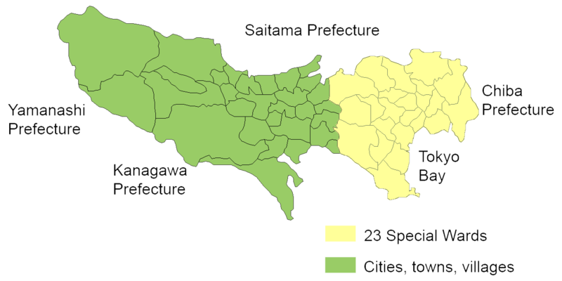
English: Map of mainland portion of Tokyo showing neighboring prefectures and Tokyo Bay
Deutsch: Karte der Präfektur Tokio, Gelb: die 23 Sonderbezirke; Grün: umliegende Gemeinden
Thanks to Aoki Shigenobu and [1]
Other versions:
- Italian: Image:TokyoMapCurrent it.png

|
Shigenobu AOKI, the copyright holder of this work, allows anyone to use it for any purpose including unrestricted redistribution, commercial use, and modification. |
संचिकेचा इतिहास
संचिकेची त्यावेळची आवृत्ती बघण्यासाठी त्या दिनांक/वेळेवर टिचकी द्या.
| दिनांक/वेळ | छोटे चित्र | आकार | सदस्य | प्रतिक्रीया | |
|---|---|---|---|---|---|
| सद्य | ०१:५९, २४ सप्टेंबर २००६ | | १,२८० × ६४० (५४ कि.बा.) | JR98664 | |
| ०७:२५, २४ एप्रिल २००५ |  | १,४४० × ८०१ (४३ कि.बा.) | Fg2 | Replaced color in key | |
| १७:२२, २३ एप्रिल २००५ |  | १,४४० × ८०१ (४३ कि.बा.) | Fg2 |
दुवे
या चित्राशी जोडलेली पृष्ठे नाहीत.
जागतिक संचिका उपयोग
संचिकाचे इतर विकिपीडियावरील वापरः
- en.wikipedia.org वरील उपयोग