
चित्र:ONT airport map.PNG
या झलकेचा आकार: ८०० × ५५७ पिक्सेल पिक्सेल. इतर resolutions: ३२० × २२३ पिक्सेल | ६४० × ४४६ पिक्सेल | १,०२४ × ७१३ पिक्सेल | १,१३१ × ७८८ पिक्सेल.
मूळ संचिका (१,१३१ × ७८८ पिक्सेल, संचिकेचा आकार: १०१ कि.बा., MIME प्रकार: image/png)
सारांश
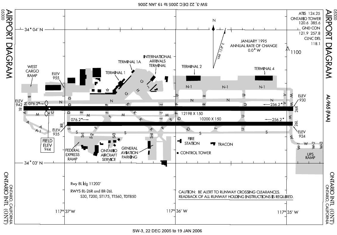
English: Airport diagram for Ontario International Airport.
- Located in Ontario, Inland Empire, Southern California.
This image or file is a work of a Federal Aviation Administration employee, taken or made as part of that person's official duties. As a work of the U.S. federal government, the image is in the public domain in the United States.
|
 |
संचिकेचा इतिहास
संचिकेची त्यावेळची आवृत्ती बघण्यासाठी त्या दिनांक/वेळेवर टिचकी द्या.
| दिनांक/वेळ | छोटे चित्र | आकार | सदस्य | प्रतिक्रीया | |
|---|---|---|---|---|---|
| सद्य | ०४:१७, ७ जानेवारी २००६ | | १,१३१ × ७८८ (१०१ कि.बा.) | Cmprince | Aiport diagram for Ontario International Airport {{PD-USGov-FAA}} |
दुवे
खालील पाने या संचिकेला जोडली आहेत:
जागतिक संचिका उपयोग
संचिकाचे इतर विकिपीडियावरील वापरः
- af.wikipedia.org वरील उपयोग
- cs.wikipedia.org वरील उपयोग
- de.wikipedia.org वरील उपयोग
- en.wikipedia.org वरील उपयोग
- es.wikipedia.org वरील उपयोग
- fr.wikipedia.org वरील उपयोग
- id.wikipedia.org वरील उपयोग
- ja.wikipedia.org वरील उपयोग
- pl.wikipedia.org वरील उपयोग
- ur.wikipedia.org वरील उपयोग
- zh.wikipedia.org वरील उपयोग