
चित्र:Missouri-Floyd Rivers Sioux City Iowa.jpg
या झलकेचा आकार: ८०० × ५३३ पिक्सेल पिक्सेल. इतर resolutions: ३२० × २१३ पिक्सेल | ६४० × ४२७ पिक्सेल | १,०२४ × ६८३ पिक्सेल | १,५०० × १,००० पिक्सेल.
मूळ संचिका (१,५०० × १,००० पिक्सेल, संचिकेचा आकार: ७११ कि.बा., MIME प्रकार: image/jpeg)
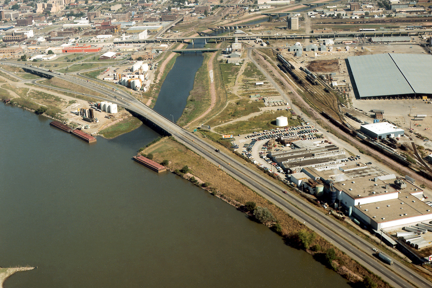
| वर्णन | Aerial view of Sioux City, Iowa, USA, at the confluence of the Missouri and Floyd Rivers. Interstate-29 crosses the mouth of the Floyd River. | |||
| Location | Sioux City, Iowa, USA 42°28′58.75″N 96°23′29.44″W / 42.4829861°N 96.3915111°W |
|||
| दिनांक | not specified | |||
| स्रोत |
U.S. Army Corps of Engineers Digital Visual Library Image page Image description page Digital Visual Library home page |
|||
| लेखक | Robert Etzel, U.S. Army Corps of Engineers | |||
| परवानगी (या संचिकेचा पुनर्वापर करीत आहे) |
|
संचिकेचा इतिहास
संचिकेची त्यावेळची आवृत्ती बघण्यासाठी त्या दिनांक/वेळेवर टिचकी द्या.
| दिनांक/वेळ | छोटे चित्र | आकार | सदस्य | प्रतिक्रीया | |
|---|---|---|---|---|---|
| सद्य | ०९:५३, १९ मार्च २००७ | | १,५०० × १,००० (७११ कि.बा.) | DanMS | {{Information | Description = Aerial view of Sioux City, Iowa, USA, at the confluence of the Missouri and Floyd Rivers. Interstate-29 crosses the mouth of the Floyd River. | Source = U.S. Army Corps of Engineers Digital Visual Library<br />[http://im |
दुवे
खालील पाने या संचिकेला जोडली आहेत:
जागतिक संचिका उपयोग
संचिकाचे इतर विकिपीडियावरील वापरः
- arz.wikipedia.org वरील उपयोग
- ast.wikipedia.org वरील उपयोग
- ceb.wikipedia.org वरील उपयोग
- de.wikipedia.org वरील उपयोग
- en.wikipedia.org वरील उपयोग
- es.wikipedia.org वरील उपयोग
- fa.wikipedia.org वरील उपयोग
- fr.wikipedia.org वरील उपयोग
- gl.wikipedia.org वरील उपयोग
- incubator.wikimedia.org वरील उपयोग
- ja.wikipedia.org वरील उपयोग
- pt.wikipedia.org वरील उपयोग
- ru.wikipedia.org वरील उपयोग
- ta.wikipedia.org वरील उपयोग
- uk.wikipedia.org वरील उपयोग
- www.wikidata.org वरील उपयोग