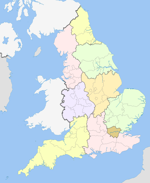
चित्र:English regions 2009.svg
Appearance

Size of this PNG preview of this SVG file: ४९४ × ६०० पिक्सेल. इतर resolutions: १९८ × २४० पिक्सेल | ३९५ × ४८० पिक्सेल | ६३३ × ७६८ पिक्सेल | ८४३ × १,०२४ पिक्सेल | १,६८७ × २,०४८ पिक्सेल | १,१०८ × १,३४५ पिक्सेल.
मूळ संचिका (SVG संचिका, साधारणपणे १,१०८ × १,३४५ pixels, संचिकेचा आकार: ३६५ कि.बा.)
संचिकेचा इतिहास
संचिकेची त्यावेळची आवृत्ती बघण्यासाठी त्या दिनांक/वेळेवर टिचकी द्या.
| दिनांक/वेळ | छोटे चित्र | आकार | सदस्य | प्रतिक्रीया | |
|---|---|---|---|---|---|
| सद्य | ०१:३४, २२ एप्रिल २०१२ |  | १,१०८ × १,३४५ (३६५ कि.बा.) | Dr Greg | == {{int:filedesc}} == {{Information |Description={{en|Map showing the en:Regions of England and the constituent metropolitan and non-metropolitan counties, in 2009. Equirectangular m... |
दुवे
खालील पाने या संचिकेला जोडली आहेत:
जागतिक संचिका उपयोग
संचिकाचे इतर विकिपीडियावरील वापरः
- ban.wikipedia.org वरील उपयोग
- bg.wikipedia.org वरील उपयोग
- bs.wikipedia.org वरील उपयोग
- en.wikipedia.org वरील उपयोग
- List of forests in the United Kingdom
- Subdivisions of England
- Regional assembly (England)
- Regional development agency
- Lists of schools in England
- User:Ric36/Sandbox
- Talk:Politics of England
- Template:England Labelled Map
- United Kingdom constitutional law
- Local authority leaders' board
- Regions of England
- Category:People by region in England
- Category:Cities in England by region
- Category:NUTS 1 statistical regions of England
- Devolution in the United Kingdom
- User talk:Iridescent/Archive 17
- Category:British school stubs
- User:Ric36/sandbox
- User:Bermicourt/Template:Lists of hills of English counties
- List of British regions by life expectancy
- es.wikipedia.org वरील उपयोग
- fo.wikipedia.org वरील उपयोग
- fr.wikipedia.org वरील उपयोग
- hi.wikipedia.org वरील उपयोग
- id.wikipedia.org वरील उपयोग
- it.wikipedia.org वरील उपयोग
- ja.wikipedia.org वरील उपयोग
- ja.wikibooks.org वरील उपयोग
- lv.wikipedia.org वरील उपयोग
- pl.wikipedia.org वरील उपयोग
- pnb.wikipedia.org वरील उपयोग
- pt.wikipedia.org वरील उपयोग
या संचिकेचे अधिक वैश्विक उपयोग पहा


