
चित्र:Taiwan location map.svg

Size of this PNG preview of this SVG file: ४९९ × ६०० पिक्सेल. इतर resolutions: २०० × २४० पिक्सेल | ३९९ × ४८० पिक्सेल | ६३९ × ७६८ पिक्सेल | ८५२ × १,०२४ पिक्सेल | १,७०४ × २,०४८ पिक्सेल | १,०१६ × १,२२१ पिक्सेल.
मूळ संचिका (SVG संचिका, साधारणपणे १,०१६ × १,२२१ pixels, संचिकेचा आकार: १२१ कि.बा.)

|
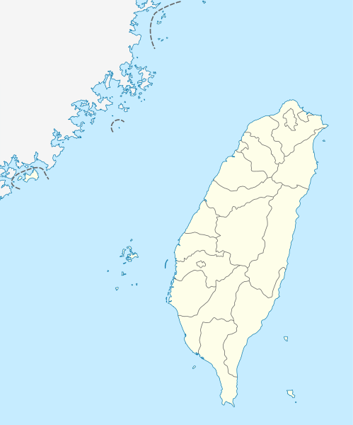
The boundaries on this map show the de facto situation. This is just one of several different views on the subject (see COM:NPOV). |
सारांश
| वर्णन |
Quadratische Plattkarte, N-S-Streckung 110 %. Geographische Begrenzung der Karte:
Equirectangular projection, N/S stretching 110 %. Geographic limits of the map:
|
| दिनांक | |
| स्रोत | own work, using United States National Imagery and Mapping Agency data |
| लेखक | NordNordWest |

|
This map has been made or improved in the German Kartenwerkstatt (Map Lab). You can propose maps to improve as well.
|
परवाना:
मी, या कामाचा/कामाची परवानाधारक, खालील परवान्यांअंतर्गत हे काम येथे प्रकाशित करत आहे :

|
फ्री सॉफ्टवेअर फाऊंडेशन द्वारे प्रकाशित जीएनयू मुक्त दस्ताऐवजीकरण परवाना, आवृत्ती १.२ किंवा त्यानंतरची,या अंतर्गत; या दस्तावेजास, नकलविण्याची, वितरणाची व/किंवा फेरबदलाची परवानगी दिल्या जाते या अटींसह कि त्यात कोणतेही निश्चलित(Invariant) विभाग नकोत,पृष्टपान मजकूर नको व मलपान मजकूर नको. GNU Free Documentation License हा मथळा असलेल्या विभागात,या परवान्याची प्रत अंतर्भूत केलेली आहे. |
ही संचिका खालील परवान्याअंतर्गत आहे - क्रीएटिव्ह कॉमन्स Attribution-Share Alike 3.0 Unported.
- तुम्ही मुक्त आहात.
- सामायिक करा – नक्कल, वितरण आणि पारेषित करण्यास
- पुर्नमिश्रीत करण्यास – काम गरजेनुसार अनुकुलीत करण्यास
- खालील अटींच्या अधिन राहून:
- रोपण – आपण योग्य क्रेडिट देणे आवश्यक आहे, परवान्यास दुवा प्रदान करणे आवश्यक आहे, आणि बदल केले गेले आहेत हे दर्शविणे आवश्यक आहे. आपण हे कोणत्याही वाजवी मार्गाने करू शकता, परंतु परवानाधारक आपल्यास किंवा आपल्या वापरास मान्यता देतो अशा कोणत्याही मार्गाने नाही.
- जसेहोते-वाटातसेच (शेअर अलाईक) – जर तुम्ही या कामात काही बदल केलात, काटछाट केलीत, किंवा भर घातली, तर असे करून बनलेले नवीन काम तुम्ही केवळ या किंवा यासारख्याच परवान्याअंतर्गत प्रसारित करू शकतात.
तुमच्या पसंतीचा परवाना तुम्ही निवडू शकता.
संचिकेचा इतिहास
संचिकेची त्यावेळची आवृत्ती बघण्यासाठी त्या दिनांक/वेळेवर टिचकी द्या.
| दिनांक/वेळ | छोटे चित्र | आकार | सदस्य | प्रतिक्रीया | |
|---|---|---|---|---|---|
| सद्य | १६:४५, २२ ऑगस्ट २०११ | | १,०१६ × १,२२१ (१२१ कि.बा.) | NordNordWest | minor corrections |
| १७:२४, १९ जुलै २०११ |  | १,०१६ × १,२२२ (१६६ कि.बा.) | Bencmq | Reverted to the version before dispute | |
| १५:१६, १९ जुलै २०११ |  | १,०१६ × १,२२२ (१५६ कि.बा.) | JOSH tw | You did not answer my query. If you would like to use this file on global website of wiki commons, you have to consider different concepts in order to keep it neutral | |
| १२:५४, १९ जुलै २०११ |  | १,०१६ × १,२२१ (१२१ कि.बा.) | NordNordWest | You can upload a new file if you want to, but don't change the status that is shown here. Next revert -> COM:V | |
| ०९:५०, १९ जुलै २०११ |  | १,०१६ × १,२२२ (१५६ कि.बा.) | JOSH tw | If Kosovo as an UN unreconignized state can be shown on distinct appearance with Serbia, there is unreasonable to treat each other differently... especially P.R.China has never ruled Taiwan at any period of history | |
| ०३:२९, १९ जुलै २०११ |  | १,०१६ × १,२२१ (१२१ कि.बा.) | NordNordWest | please don't change the political status shown in this map | |
| ०१:५३, १९ जुलै २०११ |  | १,०१६ × १,२२२ (१५६ कि.बा.) | JOSH tw | Fixed map, political divisions have changed | |
| २२:२४, ३ जून २०११ |  | १,०१६ × १,२२१ (१२७ कि.बा.) | NordNordWest | please don't change the political status shown in this map | |
| १८:४९, ३ जून २०११ |  | १,०१६ × १,२२२ (१५६ कि.बा.) | Energiya | Fix the border of Matsu(Dongyin) and Kinmen (Dadan, Erdan, Wuqiu) see the page of Matsu Island and Kinmen. | |
| २२:४९, २८ डिसेंबर २०१० |  | १,०१६ × १,२२२ (१६६ कि.बा.) | NordNordWest | wrong upd |
दुवे
खालील पाने या संचिकेला जोडली आहेत:
जागतिक संचिका उपयोग
संचिकाचे इतर विकिपीडियावरील वापरः
- af.wikipedia.org वरील उपयोग
- an.wikipedia.org वरील उपयोग
- ar.wikipedia.org वरील उपयोग
- ast.wikipedia.org वरील उपयोग
- Taiwán
- Taipei 101
- Taipéi
- Nuevu Taipéi
- Keelung
- Taoyuan
- Taichung
- Muséu Nacional del Palaciu
- Islles Pescadores
- Módulu:Mapa de llocalización/datos/República de China
- Módulu:Mapa de llocalización/datos/Taiwán
- Módulu:Mapa de llocalización/datos/República de China/usu
- Aeropuertu Internacional de Taiwán Taoyuan
- Puertu de Kaohsiung
- Puertu de Taipéi
- az.wikipedia.org वरील उपयोग
- ba.wikipedia.org वरील उपयोग
- bcl.wikipedia.org वरील उपयोग
- be.wikipedia.org वरील उपयोग
- bg.wikipedia.org वरील उपयोग
- bn.wikipedia.org वरील उपयोग
- bs.wikipedia.org वरील उपयोग
- ceb.wikipedia.org वरील उपयोग
या संचिकेचे अधिक वैश्विक उपयोग पहा