
चित्र:Map of the Federated States of Micronesia CIA.jpg

या झलकेचा आकार: ७४० × ५९९ पिक्सेल पिक्सेल. इतर resolutions: २९६ × २४० पिक्सेल | ५९३ × ४८० पिक्सेल | ९४८ × ७६८ पिक्सेल | १,२०० × ९७२ पिक्सेल.
मूळ संचिका (१,२०० × ९७२ पिक्सेल, संचिकेचा आकार: ३१२ कि.बा., MIME प्रकार: image/jpeg)
सारांश
| वर्णन |
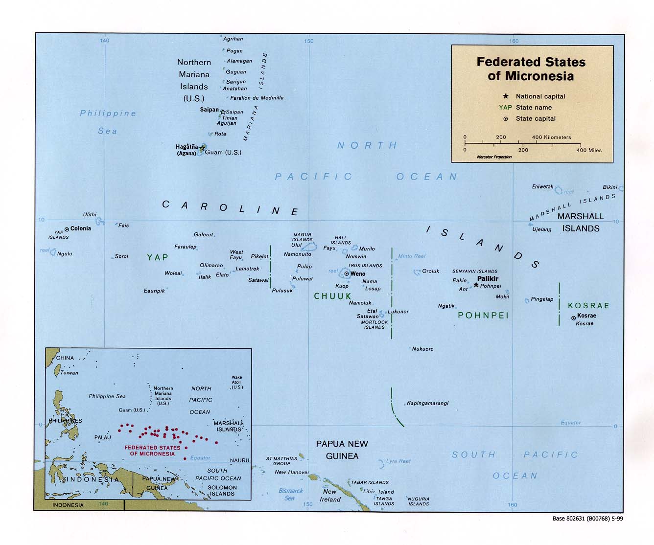
English: Map of the Federated States of Micronesia — in the Micronesia regon. |
| दिनांक | |
| स्रोत | Federated States of Micronesia (Political) 1999 from Perry-Castañeda Library Map Collection: Federated States of Micronesia Maps |
| लेखक | U.S. Central Intelligence Agency |
| परवानगी (या संचिकेचा पुनर्वापर करीत आहे) |
Public domain |
परवाना:
| This image is a work of a Central Intelligence Agency employee, taken or made as part of that person's official duties. As a Work of the United States Government, this image or media is in the public domain in the United States.
|

|
संचिकेचा इतिहास
संचिकेची त्यावेळची आवृत्ती बघण्यासाठी त्या दिनांक/वेळेवर टिचकी द्या.
| दिनांक/वेळ | छोटे चित्र | आकार | सदस्य | प्रतिक्रीया | |
|---|---|---|---|---|---|
| सद्य | २१:२७, १७ सप्टेंबर २०१० | | १,२०० × ९७२ (३१२ कि.बा.) | Ras67 | rotated 0.22 degree ccw, cropped |
| १४:३९, २२ जानेवारी २००५ |  | १,३३६ × १,११४ (१४० कि.बा.) | Hoshie | CIA map of FSM. {{PD-PCL|http://www.lib.utexas.edu/maps/islands_oceans_poles/micronesia_pol99.jpg}} |
दुवे
खालील पाने या संचिकेला जोडली आहेत:
जागतिक संचिका उपयोग
संचिकाचे इतर विकिपीडियावरील वापरः
- af.wikipedia.org वरील उपयोग
- ami.wikipedia.org वरील उपयोग
- an.wikipedia.org वरील उपयोग
- ar.wikipedia.org वरील उपयोग
- ary.wikipedia.org वरील उपयोग
- avk.wikipedia.org वरील उपयोग
- az.wikipedia.org वरील उपयोग
- bg.wikipedia.org वरील उपयोग
- bn.wikipedia.org वरील उपयोग
- ca.wikipedia.org वरील उपयोग
- cs.wikipedia.org वरील उपयोग
- cv.wikipedia.org वरील उपयोग
- da.wikipedia.org वरील उपयोग
- de.wikipedia.org वरील उपयोग
- el.wikipedia.org वरील उपयोग
- en.wikipedia.org वरील उपयोग
- Federated States of Micronesia
- History of the Federated States of Micronesia
- Geography of the Federated States of Micronesia
- Ecclesiastical provinces and dioceses of the Episcopal Church
- User:Jonny-mt/Gallery of current first-level administrative country subdivisions maps
- Outline of the Federated States of Micronesia
- Index of Federated States of Micronesia–related articles
- Isokelekel
- List of islands of the Federated States of Micronesia
- Naval Base Ulithi
- US Naval Base Carolines
- 2023 Micronesian constitutional referendum
- eo.wikipedia.org वरील उपयोग
- es.wikipedia.org वरील उपयोग
- eu.wikipedia.org वरील उपयोग
- fa.wikipedia.org वरील उपयोग
- fi.wikipedia.org वरील उपयोग
- fr.wikipedia.org वरील उपयोग
या संचिकेचे अधिक वैश्विक उपयोग पहा