
चित्र:Map of Russia - North Caucasian Federal District.svg

Size of this PNG preview of this SVG file: ८०० × ४६२ पिक्सेल. इतर resolutions: ३२० × १८५ पिक्सेल | ६४० × ३६९ पिक्सेल | १,०२४ × ५९१ पिक्सेल | १,२८० × ७३८ पिक्सेल | २,५६० × १,४७७ पिक्सेल | १,०९२ × ६३० पिक्सेल.
मूळ संचिका (SVG संचिका, साधारणपणे १,०९२ × ६३० pixels, संचिकेचा आकार: ९५ कि.बा.)

|
The boundaries on this map show the de facto situation. This is just one of several different views on the subject (see COM:NPOV). |
| वर्णन |
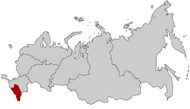
English: Map Russia highlighting the North Caucasian Federal districts.
Русский: Северо-Кавказский федеральный округ |
| दिनांक | (UTC) |
| स्रोत | Based on Map_of_Russian_subjects,_2008-03-01.svg |
| लेखक |
original: fremantleboy |
I, the copyright holder of this work, hereby publish it under the following license:
ही संचिका खालील परवान्याअंतर्गत आहे - क्रीएटिव्ह कॉमन्स Attribution 2.5 Generic.
- तुम्ही मुक्त आहात.
- सामायिक करा – नक्कल, वितरण आणि पारेषित करण्यास
- पुर्नमिश्रीत करण्यास – काम गरजेनुसार अनुकुलीत करण्यास
- खालील अटींच्या अधिन राहून:
- रोपण – आपण योग्य क्रेडिट देणे आवश्यक आहे, परवान्यास दुवा प्रदान करणे आवश्यक आहे, आणि बदल केले गेले आहेत हे दर्शविणे आवश्यक आहे. आपण हे कोणत्याही वाजवी मार्गाने करू शकता, परंतु परवानाधारक आपल्यास किंवा आपल्या वापरास मान्यता देतो अशा कोणत्याही मार्गाने नाही.
चढवल्याचे मुळ विवरण
This image is a derivative work of the following images:
- File:Map_of_Russian_subjects,_2008-03-01.svg licensed with Cc-by-2.5
- 2008-03-03T22:55:39Z Lokal Profil 1092x630 (296622 Bytes) Argh, updated using the wrong map. This is the 2008-03-01 map with federal district borders
- 2008-03-03T22:47:17Z Lokal Profil 1092x630 (295603 Bytes) Added thicker lines for Federal districts
- 2008-01-27T20:08:20Z Lokal Profil 1092x630 (227563 Bytes) Oupps... readded surrounding countries
- 2008-01-27T20:05:54Z Lokal Profil 1092x630 (191297 Bytes) Now also tagged by subject type
- 2008-01-26T23:00:44Z Lokal Profil 1092x630 (225978 Bytes) {{Information |Description=Map of Russia with merged subjects (01.03.2008, last merger [[w:en:Chita Oblast|Chita Oblast]]+[[w:en:Agin-Buryat Autonomous Okrug|Agin-Buryat Autonomous Okrug]] to form Zabaykalsky Krai.) The subje
Uploaded with derivativeFX
संचिकेचा इतिहास
संचिकेची त्यावेळची आवृत्ती बघण्यासाठी त्या दिनांक/वेळेवर टिचकी द्या.
| दिनांक/वेळ | छोटे चित्र | आकार | सदस्य | प्रतिक्रीया | |
|---|---|---|---|---|---|
| सद्य | १९:५१, १० मार्च २०१५ | | १,०९२ × ६३० (९५ कि.बा.) | Knyaz-1988 | Reverted to version as of 22:11, 3 November 2014 |
| ०६:५८, ४ नोव्हेंबर २०१४ |  | १,०९२ × ६३० (११८ कि.बा.) | Fry1989 | NPOV issue. | |
| ०३:४१, ४ नोव्हेंबर २०१४ |  | १,०९२ × ६३० (९५ कि.बा.) | Knyaz-1988 | New version | |
| ०३:३४, २२ जानेवारी २०१० |  | १,०९२ × ६३० (११८ कि.बा.) | Denhud | {{Information |Description={{en|Map Russia highlighting the North Caucasian Federal districts.}} {{Ru|Северо-Кавказский федеральный округ}} |Source=Based on [[:File:Map_of_Russian_subject |
दुवे
खालील पाने या संचिकेला जोडली आहेत:
जागतिक संचिका उपयोग
संचिकाचे इतर विकिपीडियावरील वापरः
- ar.wikipedia.org वरील उपयोग
- arz.wikipedia.org वरील उपयोग
- azb.wikipedia.org वरील उपयोग
- be-tarask.wikipedia.org वरील उपयोग
- be.wikipedia.org वरील उपयोग
- bg.wikipedia.org वरील उपयोग
- ca.wikipedia.org वरील उपयोग
- el.wikipedia.org वरील उपयोग
- en.wikipedia.org वरील उपयोग
- es.wikipedia.org वरील उपयोग
- et.wikipedia.org वरील उपयोग
- eu.wikipedia.org वरील उपयोग
- fa.wikipedia.org वरील उपयोग
- hu.wikipedia.org वरील उपयोग
- ja.wikipedia.org वरील उपयोग
- kk.wikipedia.org वरील उपयोग
- ko.wikipedia.org वरील उपयोग
- mk.wikipedia.org वरील उपयोग
- nl.wikipedia.org वरील उपयोग
- pfl.wikipedia.org वरील उपयोग
- pl.wikipedia.org वरील उपयोग
- pl.wikivoyage.org वरील उपयोग
- pt.wikipedia.org वरील उपयोग
- ru.wikinews.org वरील उपयोग
- sv.wikipedia.org वरील उपयोग
- th.wikipedia.org वरील उपयोग
- tl.wikipedia.org वरील उपयोग
- tr.wikipedia.org वरील उपयोग
- uk.wikipedia.org वरील उपयोग
- vi.wikipedia.org वरील उपयोग
- www.wikidata.org वरील उपयोग
- zh-yue.wikipedia.org वरील उपयोग
- zh.wikipedia.org वरील उपयोग