
चित्र:Locator map Iran Alborz Province.png
यापेक्षा मोठे चित्र उपलब्ध नाही.
Locator_map_Iran_Alborz_Province.png (६७२ × ६०० पिक्सेल, संचिकेचा आकार: १४३ कि.बा., MIME प्रकार: image/png)
| वर्णन |
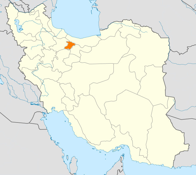
English: Location map of Iran. Equirectangular projection. Strechted by 118.0%. Geographic limits of the map: * N: 40.0° N * S: 24.5° N * W: 43.5° E * E: 64.0° E Made with Natural Earth. Free vector and raster map data @ naturalearthdata.com. |
| दिनांक | (UTC) |
| स्रोत | |
| लेखक |
|
| This is a retouched picture, which means that it has been digitally altered from its original version. Modifications: New map with Alborz province highlighted.. The original can be viewed here: Iran location map.svg:
|
मी, या कामाचा/कामाची परवानाधारक, खालील परवान्यांअंतर्गत हे काम येथे प्रकाशित करत आहे :
ही संचिका खालील परवान्याअंतर्गत आहे - क्रीएटिव्ह कॉमन्स Attribution-Share Alike 3.0 Unported.
- तुम्ही मुक्त आहात.
- सामायिक करा – नक्कल, वितरण आणि पारेषित करण्यास
- पुर्नमिश्रीत करण्यास – काम गरजेनुसार अनुकुलीत करण्यास
- खालील अटींच्या अधिन राहून:
- रोपण – आपण योग्य क्रेडिट देणे आवश्यक आहे, परवान्यास दुवा प्रदान करणे आवश्यक आहे, आणि बदल केले गेले आहेत हे दर्शविणे आवश्यक आहे. आपण हे कोणत्याही वाजवी मार्गाने करू शकता, परंतु परवानाधारक आपल्यास किंवा आपल्या वापरास मान्यता देतो अशा कोणत्याही मार्गाने नाही.
- जसेहोते-वाटातसेच (शेअर अलाईक) – जर तुम्ही या कामात काही बदल केलात, काटछाट केलीत, किंवा भर घातली, तर असे करून बनलेले नवीन काम तुम्ही केवळ या किंवा यासारख्याच परवान्याअंतर्गत प्रसारित करू शकतात.

|
फ्री सॉफ्टवेअर फाऊंडेशन द्वारे प्रकाशित जीएनयू मुक्त दस्ताऐवजीकरण परवाना, आवृत्ती १.२ किंवा त्यानंतरची,या अंतर्गत; या दस्तावेजास, नकलविण्याची, वितरणाची व/किंवा फेरबदलाची परवानगी दिल्या जाते या अटींसह कि त्यात कोणतेही निश्चलित(Invariant) विभाग नकोत,पृष्टपान मजकूर नको व मलपान मजकूर नको. GNU Free Documentation License हा मथळा असलेल्या विभागात,या परवान्याची प्रत अंतर्भूत केलेली आहे. |
तुमच्या पसंतीचा परवाना तुम्ही निवडू शकता.
चढवल्याचे मुळ विवरण
This image is a derivative work of the following images:
- File:Iran_location_map.svg licensed with Cc-by-sa-3.0, GFDL
- 2010-07-11T20:08:23Z Uwe Dedering 1200x1071 (655114 Bytes) 31. province Alborz
- 2010-02-18T17:44:29Z Uwe Dedering 1200x1071 (721726 Bytes) Bahrain above water, no disputed countries
- 2010-02-18T13:00:48Z Uwe Dedering 1200x1071 (725716 Bytes) {{Information |Description={{en|1=Location map of Iran. Equirectangular projection. Strechted by 118.0%. Geographic limits of the map: * N: 40.0° N * S: 24.5° N * W: 43.5° E * E: 64.0° E Made with Natural Earth. Fre
Uploaded with derivativeFX
संचिकेचा इतिहास
संचिकेची त्यावेळची आवृत्ती बघण्यासाठी त्या दिनांक/वेळेवर टिचकी द्या.
| दिनांक/वेळ | छोटे चित्र | आकार | सदस्य | प्रतिक्रीया | |
|---|---|---|---|---|---|
| सद्य | ०२:१८, २५ जानेवारी २०११ | | ६७२ × ६०० (१४३ कि.बा.) | WikiDaisy | {{Information |Description={{en|1=Location map of Iran. Equirectangular projection. Strechted by 118.0%. Geographic limits of the map: * N: 40.0° N * S: 24.5° N * W: 43.5° E * E: 64.0° E Made with Natural Earth. Free vector and raster map data @ |
दुवे
खालील पाने या संचिकेला जोडली आहेत:
जागतिक संचिका उपयोग
संचिकाचे इतर विकिपीडियावरील वापरः
- ceb.wikipedia.org वरील उपयोग
- hak.wikipedia.org वरील उपयोग
- hi.wikipedia.org वरील उपयोग
- hr.wikipedia.org वरील उपयोग
- mk.wikipedia.org वरील उपयोग
- no.wikipedia.org वरील उपयोग
- pa.wikipedia.org वरील उपयोग
- pl.wikipedia.org वरील उपयोग
- pl.wikivoyage.org वरील उपयोग
- ps.wikipedia.org वरील उपयोग
- sco.wikipedia.org वरील उपयोग
- sh.wikipedia.org वरील उपयोग
- sv.wikipedia.org वरील उपयोग
- tr.wikipedia.org वरील उपयोग
- Kerec
- İran'daki yerleşim birimleri listesi
- Elburz (eyalet)
- Kerec şehristanı
- Nezerabad şehristanı
- Savucbulag şehristanı
- Şablon:Elburz Eyaleti
- Nezerabad
- Heştgerd
- Kerec merkezî bahşı
- İştihard şehristanı
- Asara bahşı
- Nezerabad merkezî bahşı
- Tankaman bahşı
- Savucbulag merkezî bahşı
- Çendar bahşı
- Çeharbağ bahşı
- Taligan merkezî bahşı
- Asara
- İştihard
- Taligan
- Germdere
- Kemalşehr
- Mahdeşt
- Meşkindeşt
- Muhammedşehr
- Çeharbağ
- Gülsar
- Kuhsar
- Yeni Heştgerd
- ug.wikipedia.org वरील उपयोग
- war.wikipedia.org वरील उपयोग
- zh-min-nan.wikipedia.org वरील उपयोग
- zh.wikipedia.org वरील उपयोग