
चित्र:Israel Sea Level BW 1.JPG
या झलकेचा आकार: ८०० × ५३६ पिक्सेल पिक्सेल. इतर resolutions: ३२० × २१४ पिक्सेल | ६४० × ४२८ पिक्सेल | १,०२४ × ६८५ पिक्सेल | १,२८० × ८५७ पिक्सेल | २,५६० × १,७१४ पिक्सेल | ३,८७२ × २,५९२ पिक्सेल.
मूळ संचिका (३,८७२ × २,५९२ पिक्सेल, संचिकेचा आकार: २.८८ मे.बा., MIME प्रकार: image/jpeg)
सारांश
| Camera location | | View this and other nearby images on: OpenStreetMap |
|---|
| वर्णन |
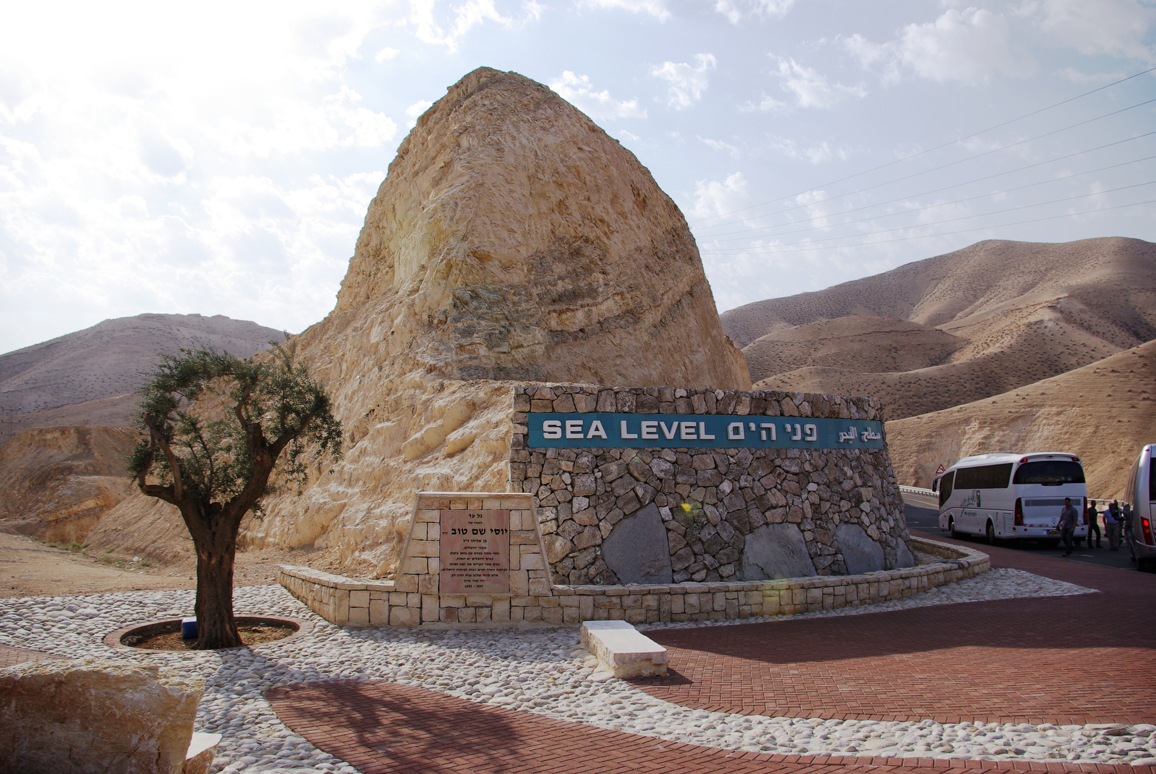
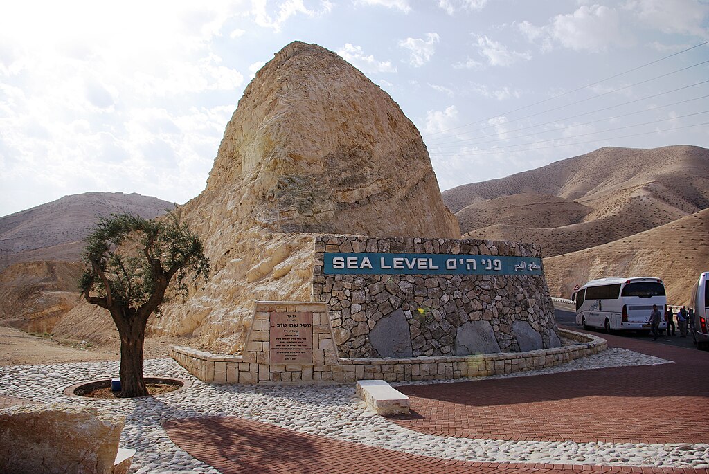
English: West Bank. Sea Level marker on the side of the road from Jerusalem to the Dead Sea
Deutsch: Westjordanland. Sea Level - Meereshöhe an der Straße von Jerusalem zum Toten Meer |
| दिनांक | |
| स्रोत | स्वतःचे काम |
| लेखक | Berthold Werner |
परवाना:
| I, the copyright holder of this work, release this work into the public domain. This applies worldwide. असे करणे काही देशांमधे कायद्यानुसार शक्य नसू शकते. असे असल्यास : मी कोणालाही कोणत्याही कारणासाठी हे काम वापरण्याचे अधिकार कोणत्याही बंधनाशिवाय जर अशी बंधने कायद्याने बंधनकारक नसतीलतर देत आहोत. |
संचिकेचा इतिहास
संचिकेची त्यावेळची आवृत्ती बघण्यासाठी त्या दिनांक/वेळेवर टिचकी द्या.
| दिनांक/वेळ | छोटे चित्र | आकार | सदस्य | प्रतिक्रीया | |
|---|---|---|---|---|---|
| सद्य | २२:१०, १९ फेब्रुवारी २०१३ | | ३,८७२ × २,५९२ (२.८८ मे.बा.) | Soerfm | Contrast |
| ००:२४, २५ जानेवारी २००९ |  | ३,८७२ × २,५९२ (२.७२ मे.बा.) | Berthold Werner | {{Information |Description={{en|1=Israel. Sea Level at the street from Jerusalem to the Dead Sea}} {{de|1=Israel. Sea Level - Meereshöhe an der Straße von Jerusalem zum Toten Meer}} |Source=Eigenes Werk (own work) |Author=[[User:Berthold Werner|Berthold |
दुवे
खालील पाने या संचिकेला जोडली आहेत:
जागतिक संचिका उपयोग
संचिकाचे इतर विकिपीडियावरील वापरः
- af.wikipedia.org वरील उपयोग
- ar.wikipedia.org वरील उपयोग
- ast.wikipedia.org वरील उपयोग
- bn.wikipedia.org वरील उपयोग
- de.wikipedia.org वरील उपयोग
- en.wikipedia.org वरील उपयोग
- es.wikipedia.org वरील उपयोग
- et.wikipedia.org वरील उपयोग
- fa.wikipedia.org वरील उपयोग
- fr.wikipedia.org वरील उपयोग
- gu.wikipedia.org वरील उपयोग
- ha.wikipedia.org वरील उपयोग
- he.wikipedia.org वरील उपयोग
- hi.wikipedia.org वरील उपयोग
- ia.wikipedia.org वरील उपयोग
- ilo.wikipedia.org वरील उपयोग
- incubator.wikimedia.org वरील उपयोग
- io.wikipedia.org वरील उपयोग
- is.wikipedia.org वरील उपयोग
- ku.wikipedia.org वरील उपयोग
- mg.wikipedia.org वरील उपयोग
- mk.wikipedia.org वरील उपयोग
- my.wikipedia.org वरील उपयोग
- pms.wikipedia.org वरील उपयोग
- ro.wikipedia.org वरील उपयोग
- rue.wikipedia.org वरील उपयोग
- ru.wikipedia.org वरील उपयोग
- sk.wikipedia.org वरील उपयोग
- sl.wikipedia.org वरील उपयोग
- so.wikipedia.org वरील उपयोग
- sr.wikipedia.org वरील उपयोग
- tt.wikipedia.org वरील उपयोग
- uk.wikipedia.org वरील उपयोग
- ur.wikipedia.org वरील उपयोग
- uz.wikipedia.org वरील उपयोग
- vi.wikipedia.org वरील उपयोग
- war.wikipedia.org वरील उपयोग
- www.wikidata.org वरील उपयोग
- zh-min-nan.wikipedia.org वरील उपयोग