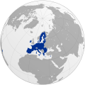
चित्र:Europe subregion map UN geoscheme.svg

Size of this PNG preview of this SVG file: ६८० × ५२० पिक्सेल. इतर resolutions: ३१४ × २४० पिक्सेल | ६२८ × ४८० पिक्सेल | १,००४ × ७६८ पिक्सेल | १,२८० × ९७९ पिक्सेल | २,५६० × १,९५८ पिक्सेल.
मूळ संचिका (SVG संचिका, साधारणपणे ६८० × ५२० pixels, संचिकेचा आकार: २२८ कि.बा.)
संचिकेचा इतिहास
संचिकेची त्यावेळची आवृत्ती बघण्यासाठी त्या दिनांक/वेळेवर टिचकी द्या.
| दिनांक/वेळ | छोटे चित्र | आकार | सदस्य | प्रतिक्रीया | |
|---|---|---|---|---|---|
| सद्य | १९:२०, ९ नोव्हेंबर २०२१ |  | ६८० × ५२० (२२८ कि.बा.) | TU-nor | Reverted to version as of 12:17, 22 February 2021 (UTC) No reason to color countries that are outside Europe in the Geosceme unless they are geographically transcontinental |
| ०५:४२, ६ ऑगस्ट २०२१ |  | ६८० × ५२० (२६२ कि.बा.) | Vesperius | Cleanup at the edges. | |
| ०५:२३, ६ ऑगस्ट २०२१ |  | ६८० × ५२० (२३८ कि.बा.) | Vesperius | Cyprus and Armenia included. | |
| १७:४७, २२ फेब्रुवारी २०२१ |  | ६८० × ५२० (२२८ कि.बा.) | TU-nor | Andorra is Southern Europe in UN geoscheme | |
| १६:४७, २३ सप्टेंबर २०१५ |  | ६८० × ५२० (५७२ कि.बा.) | Alex Great | Reverted to version as of 09:22, 1 June 2014 | |
| १५:१८, १० जुलै २०१५ |  | ७४४ × १,०५२ (४३० कि.बा.) | Andrej500 | Crimea | |
| १४:५२, १ जून २०१४ |  | ६८० × ५२० (५७२ कि.बा.) | Insider | Russian Sochi Sector in Asia | |
| ००:२०, २८ मे २००९ |  | ६८० × ५२० (५७१ कि.बा.) | Kolja21 | {{Information |Description={{en|1=Subregions of Europe (UN geoschme)}} {{de|1=Subregionen Europas (nach UN Geoschema)}} |Source=Eigenes Werk (own work) |Author=Kolja21 |Date=2009-05-23 |Permission= |other_ |
दुवे
खालील पाने या संचिकेला जोडली आहेत:
जागतिक संचिका उपयोग
संचिकाचे इतर विकिपीडियावरील वापरः
- af.wikipedia.org वरील उपयोग
- am.wikipedia.org वरील उपयोग
- ar.wikipedia.org वरील उपयोग
- av.wikipedia.org वरील उपयोग
- awa.wikipedia.org वरील उपयोग
- azb.wikipedia.org वरील उपयोग
- ba.wikipedia.org वरील उपयोग
- be.wikipedia.org वरील उपयोग
- bn.wikipedia.org वरील उपयोग
- br.wikipedia.org वरील उपयोग
- ce.wikipedia.org वरील उपयोग
- cs.wikipedia.org वरील उपयोग
- cv.wikipedia.org वरील उपयोग
- cy.wikipedia.org वरील उपयोग
- de.wikipedia.org वरील उपयोग
- diq.wikipedia.org वरील उपयोग
- el.wikipedia.org वरील उपयोग
- en.wikipedia.org वरील उपयोग
या संचिकेचे अधिक वैश्विक उपयोग पहा


