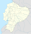
चित्र:Ecuador location map.svg

Size of this PNG preview of this SVG file: ५५६ × ५९९ पिक्सेल. इतर resolutions: २२३ × २४० पिक्सेल | ४४५ × ४८० पिक्सेल | ७१३ × ७६८ पिक्सेल | ९५० × १,०२४ पिक्सेल | १,९०१ × २,०४८ पिक्सेल | १,५३५ × १,६५४ पिक्सेल.
मूळ संचिका (SVG संचिका, साधारणपणे १,५३५ × १,६५४ pixels, संचिकेचा आकार: १.०३ मे.बा.)
संचिकेचा इतिहास
संचिकेची त्यावेळची आवृत्ती बघण्यासाठी त्या दिनांक/वेळेवर टिचकी द्या.
| दिनांक/वेळ | छोटे चित्र | आकार | सदस्य | प्रतिक्रीया | |
|---|---|---|---|---|---|
| सद्य | ०५:२७, ३ जून २०२३ |  | १,५३५ × १,६५४ (१.०३ मे.बा.) | Milenioscuro | code clean |
| ०५:२९, १९ एप्रिल २०२३ |  | १,५३५ × १,६५४ (१.९१ मे.बा.) | David C. S. | Límites | |
| ०५:२५, १९ एप्रिल २०२३ |  | १,५३५ × १,६५४ (१.९१ मे.बा.) | David C. S. | Límites y ríos | |
| ०९:००, ३ एप्रिल २०२३ |  | १,५३५ × १,६५४ (१.८६ मे.बा.) | David C. S. | Límites | |
| ०५:१०, ३१ मार्च २०२३ |  | १,५३५ × १,६५४ (१.७९ मे.बा.) | David C. S. | Límites y ríos | |
| ०४:५०, २५ मार्च २०२३ |  | १,५३५ × १,६५४ (१.५ मे.बा.) | David C. S. | Límites y ríos | |
| २१:५८, १३ फेब्रुवारी २०२३ |  | १,५३५ × १,६५४ (१.३७ मे.बा.) | David C. S. | Límites y ríos | |
| ०२:३३, २ मे २०१८ |  | १,५३५ × १,६५४ (२४६ कि.बा.) | Janitoalevic | Added Payana island to Ecuador color. | |
| ००:१८, २१ जून २०१२ |  | १,५३५ × १,६५४ (२४२ कि.बा.) | NordNordWest | upd | |
| २१:५८, १४ जून २०१२ |  | १,५३५ × १,६५४ (२३१ कि.बा.) | NordNordWest | Reverted to version as of 10:28, 14 June 2012. See your talk page. Please do not change this map again. |
दुवे
खालील पाने या संचिकेला जोडली आहेत:
जागतिक संचिका उपयोग
संचिकाचे इतर विकिपीडियावरील वापरः
- af.wikipedia.org वरील उपयोग
- an.wikipedia.org वरील उपयोग
- ar.wikipedia.org वरील उपयोग
- ast.wikipedia.org वरील उपयोग
- Quitu
- Volcán Chimborazo
- Palaciu Llexislativu d'Ecuador
- Volcán Cotopaxi
- Módulu:Mapa de llocalización/datos/Ecuador
- Campeonatu Suramericanu 1947
- Copa América 1993
- Universidá Central del Ecuador
- Aeropuertu Chachoan - Ambato
- Aeropuertu Francisco de Orellana
- Aeropuertu General Manuel Serrano - Machala
- Aeropuertu Internacional Mariscal Sucre
- Aeropuertu José María Velasco Ibarra - Macará
- Aeropuertu Jumandy
- Aeropuertu Mayor Galo de la Torre
- Aeropuertu Río Amazonas
- Aeropuertu de Lago Agrio
- Antiguu Aeropuertu Internacional Mariscal Sucre
- Puertu de Manta
- Módulu:Mapa de llocalización/datos/Ecuador/usu
- Golfu de Guayaquil
- az.wikipedia.org वरील उपयोग
- ban.wikipedia.org वरील उपयोग
- be-tarask.wikipedia.org वरील उपयोग
- be.wikipedia.org वरील उपयोग
या संचिकेचे अधिक वैश्विक उपयोग पहा


