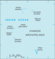
चित्र:British Indian Ocean Territory-CIA WFB Map.png
British_Indian_Ocean_Territory-CIA_WFB_Map.png (३२८ × ३५३ पिक्सेल, संचिकेचा आकार: ६ कि.बा., MIME प्रकार: image/png)
संचिकेचा इतिहास
संचिकेची त्यावेळची आवृत्ती बघण्यासाठी त्या दिनांक/वेळेवर टिचकी द्या.
| दिनांक/वेळ | छोटे चित्र | आकार | सदस्य | प्रतिक्रीया | |
|---|---|---|---|---|---|
| सद्य | १३:०४, २२ जानेवारी २००६ |  | ३२८ × ३५३ (६ कि.बा.) | Hoshie | Updated map of the British Indian Ocean Territory, from the CIA World Factbook, 10 Jan 06 rev: http://www.cia.gov/cia/publications/factbook/maps/io-map.gif |
| १४:४२, २७ मार्च २००५ |  | ३२९ × ३५५ (५ कि.बा.) | Wolfman~commonswiki | {{CIA-map}} |
दुवे
खालील पाने या संचिकेला जोडली आहेत:
जागतिक संचिका उपयोग
संचिकाचे इतर विकिपीडियावरील वापरः
- ca.wikipedia.org वरील उपयोग
- cs.wikipedia.org वरील उपयोग
- en.wikisource.org वरील उपयोग
- eo.wikipedia.org वरील उपयोग


