
चित्र:Jharkhand locator map.svg

Size of this PNG preview of this SVG file: ५०५ × ५९९ पिक्सेल. इतर resolutions: २०२ × २४० पिक्सेल | ४०४ × ४८० पिक्सेल | ६४७ × ७६८ पिक्सेल | ८६३ × १,०२४ पिक्सेल | १,७२६ × २,०४८ पिक्सेल | १,६१४ × १,९१५ पिक्सेल.
मूळ संचिका (SVG संचिका, साधारणपणे १,६१४ × १,९१५ pixels, संचिकेचा आकार: २३१ कि.बा.)
| शीर्षक |
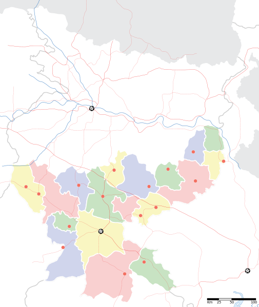
Jharkhand locator map |
||
| वर्णन |
Locator map for the Indian state of w:Jharkhand. Equirectangular projection. Geographic limits of the map: top=27.561, bottom=21.92, left=83.25, right=88.52. |
||
| दिनांक | |||
| स्रोत |
स्वतःचे काम |
||
| रचनाकार |
|
||
| परवानगी (या संचिकेचा पुनर्वापर करीत आहे) |
I, the copyright holder of this work, hereby publish it under the following license: ही संचिका खालील परवान्याअंतर्गत आहे - क्रीएटिव्ह कॉमन्स Attribution-Share Alike 3.0 Unported.
|
||
| Geotemporal data | |||
| Date depicted | second half of 20 century आणि 21 century | ||
| Georeferencing | If inappropriate please set warp_status = skip to hide. | ||
| Archival data | |||
| नोंदी | Part of WikiProject India Maps | ||
संचिकेचा इतिहास
संचिकेची त्यावेळची आवृत्ती बघण्यासाठी त्या दिनांक/वेळेवर टिचकी द्या.
| दिनांक/वेळ | छोटे चित्र | आकार | सदस्य | प्रतिक्रीया | |
|---|---|---|---|---|---|
| सद्य | १२:१६, ७ सप्टेंबर २००८ | | १,६१४ × १,९१५ (२३१ कि.बा.) | Planemad | |
| ०१:४८, ७ सप्टेंबर २००८ |  | १,६१४ × १,९१५ (१८३ कि.बा.) | Planemad | {{Information |Description={{en|1=a}} |Source=Own work by uploader |Author=PlaneMad |Date= |Permission= |other_versions= }} <!--{{ImageUpload|full}}--> |
दुवे
या चित्राशी जोडलेली पृष्ठे नाहीत.
जागतिक संचिका उपयोग
संचिकाचे इतर विकिपीडियावरील वापरः
- ar.wikipedia.org वरील उपयोग
- ast.wikipedia.org वरील उपयोग
- as.wikipedia.org वरील उपयोग
- awa.wikipedia.org वरील उपयोग
- ba.wikipedia.org वरील उपयोग
- bh.wikipedia.org वरील उपयोग
- bn.wikipedia.org वरील उपयोग
- রাঁচি
- সম্মেদ শিখর
- টেমপ্লেট:অবস্থান মানচিত্র ভারত ঝাড়খণ্ড
- ঘাটশিলা
- রাজমহল
- নেতারহাট
- মুরি
- বোকারো স্টিল সিটি
- জামতাড়া
- সোনারী বিমানবন্দর
- চাইবাসা
- চক্রধরপুর
- সাহেবগঞ্জ
- রাজমহল কয়লা খনি অঞ্চল
- বোকারো বিমানবন্দর
- পাঞ্চেত বাঁধ
- ব্যবহারকারী:খাঁ শুভেন্দু/রাঁচি
- সরাইকেল্লা
- দেওঘর বিমানবন্দর
- গিরিডি
- দুগদা
- মেদিনীনগর
- দুমকা
- রাঁচি জংশন রেলওয়ে স্টেশন
- হাজারিবাগ টাউন রেলওয়ে স্টেশন
- ধলভূমগড়
- ধলভূমগড় ব্লক
- জগন্নাথ মন্দির, রাঁচি
- bo.wikipedia.org वरील उपयोग
- ceb.wikipedia.org वरील उपयोग
- de.wikipedia.org वरील उपयोग
- fa.wikipedia.org वरील उपयोग
- hi.wikipedia.org वरील उपयोग
या संचिकेचे अधिक वैश्विक उपयोग पहा