
चित्र:Fiji (orthographic projection).svg

Size of this PNG preview of this SVG file: ५५० × ५५० पिक्सेल. इतर resolutions: २४० × २४० पिक्सेल | ४८० × ४८० पिक्सेल | ७६८ × ७६८ पिक्सेल | १,०२४ × १,०२४ पिक्सेल | २,०४८ × २,०४८ पिक्सेल.
मूळ संचिका (SVG संचिका, साधारणपणे ५५० × ५५० pixels, संचिकेचा आकार: ३१८ कि.बा.)
सारांश
| वर्णन |
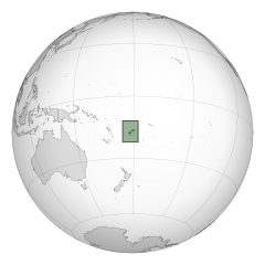
English: A map of the hemisphere centred on Fiji, using an orthographic projection, created using gringer's Perl script with Natural Earth Data (1:50000 resolution, simplified to 0.25px). Fiji is highlighted in green. |
| दिनांक | |
| स्रोत | स्वतःचे काम |
| लेखक | Gringer |
| SVG genesis |
.svg)
.svg)
.svg)
.svg)
.svg)
.svg)
.svg)
.svg)
.svg)
.svg)
.svg)
.svg)
.svg)
.svg)
.svg)
.svg)
.svg)
.svg)
.svg)
.svg)
.svg)
.svg)
.svg)
.svg)
.svg)
.svg)
.svg)
.svg)
.svg)
.svg)
.svg)
.svg)
.svg)
.svg)
.svg)
.svg)
.svg)
.svg)
.svg)
.svg)
.svg)
.svg)
.svg)
.svg)
.svg)
.svg)
.svg)
.svg)
.svg)
.svg)
.svg)
.svg)
.svg)
.svg)
.svg)
.svg)
.svg)
.svg)
.svg)
.svg)
.svg)
.svg)
.svg)
.svg)
.svg)
.svg)
.svg)
.svg)
.svg)
.svg)
.svg)
.svg)
.svg)
.svg)

.svg)

.svg)

.svg)
.svg)
.svg)
.svg)
.svg)
.svg)
.svg)


.svg)
.svg)
.svg)
.svg)
.svg)
.svg)
.svg)

.svg)
.svg)
.svg)
.svg)
.svg)
.svg)
.svg)
.svg)
.svg)

.svg)
.svg)
.svg)
.svg)
.svg)
.svg)
.svg)
_without_national_boundaries.svg)
.svg)
.svg)
.svg)
.svg)
.svg)
.svg)

.svg)
.svg)
.png)
.svg)
.svg)
.svg)
.svg)

.svg)
.svg)
.svg)
.svg)
.svg)
.svg)
.svg)
.svg)
.svg)
.svg)
.svg)

.svg)
.svg)
.svg)
.svg)
.svg)
.svg)
.svg)
.svg)
.svg)

.svg)
.svg)

.svg)
.svg)
.svg)
.svg)
.svg)
.svg)
.svg)
.svg)
.svg)
.svg)
.svg)
.svg)
.svg)
.svg)
.svg)
.svg)
.svg)
.svg)
.svg)
.svg)
.svg)
.svg)
.svg)
.svg)
.svg)
.svg)
.svg)
_-_Crimea_disputed.svg)
.svg)
.svg)
.svg)
.svg)
.svg)
.svg)
.svg)
.svg)
.svg)
.svg)
.svg)
_political.svg)
.svg)
.svg)
.svg)
.svg)
_-_Crimea_disputed_-_no_borders.svg)
.svg)
.svg)
.svg)
.svg)
.svg)
.svg)
.svg)
.svg)
.svg)
.svg)
.svg)

.svg)
.svg)
.svg)

.png)
.svg)
.svg)
.svg)
.svg)
.svg)
.svg)
.svg)
.svg)
.svg)
.svg)
.svg)
.svg)
.svg)
.svg)
.svg)
.svg)
.svg)
.svg)
.svg)
.svg)
.svg)
.svg)
.svg)
.svg)
.svg)
.svg)
.svg)
.svg)
.svg)
.svg)
.svg)
.svg)
.svg)
.svg)
.png)
.svg)
.svg)
.svg)
_(orthographic_projection).png)
.svg)
संचिकेचा इतिहास
संचिकेची त्यावेळची आवृत्ती बघण्यासाठी त्या दिनांक/वेळेवर टिचकी द्या.
| दिनांक/वेळ | छोटे चित्र | आकार | सदस्य | प्रतिक्रीया | |
|---|---|---|---|---|---|
| सद्य | ०५:०१, ३१ ऑगस्ट २०१० | | ५५० × ५५० (३१८ कि.बा.) | Gringer | Fiji highlighted by green box. |
| ०४:५५, ३१ ऑगस्ट २०१० |  | ५५० × ५५० (२७४ कि.बा.) | Gringer | {{Information |Description={{en|1=A map of the hemisphere centred on Fiji, using an orthographic projection, created using gringer's Perl script with [http://www.naturalearthdata.com/ Natural Earth Data] (1:5 |
दुवे
खालील पाने या संचिकेला जोडली आहेत:
जागतिक संचिका उपयोग
संचिकाचे इतर विकिपीडियावरील वापरः
- ace.wikipedia.org वरील उपयोग
- af.wikipedia.org वरील उपयोग
- ar.wikipedia.org वरील उपयोग
- فيجي
- مستعمرة فيجي
- مستخدم:جار الله/قائمة صور مقالات العلاقات الثنائية
- العلاقات الأمريكية الفيجية
- العلاقات الأنغولية الفيجية
- العلاقات الفيجية الكورية الجنوبية
- العلاقات الإريترية الفيجية
- العلاقات السويسرية الفيجية
- العلاقات الألمانية الفيجية
- العلاقات الفيجية الليختنشتانية
- العلاقات البوليفية الفيجية
- العلاقات الفيجية الموزمبيقية
- العلاقات الألبانية الفيجية
- العلاقات البلجيكية الفيجية
- العلاقات الإثيوبية الفيجية
- العلاقات البيلاروسية الفيجية
- العلاقات الطاجيكستانية الفيجية
- العلاقات الروسية الفيجية
- العلاقات الرومانية الفيجية
- العلاقات الأرجنتينية الفيجية
- العلاقات الغامبية الفيجية
- العلاقات الفيجية القبرصية
- العلاقات السيراليونية الفيجية
- العلاقات الفيجية النيبالية
- العلاقات الفيجية الليبيرية
- العلاقات التشيكية الفيجية
- العلاقات الفيجية الميانمارية
- العلاقات الفيجية الكندية
- العلاقات السعودية الفيجية
- العلاقات الزيمبابوية الفيجية
- العلاقات الإسرائيلية الفيجية
- العلاقات البالاوية الفيجية
- العلاقات الفيجية المالية
- العلاقات الفيجية النيجيرية
- العلاقات اليمنية الفيجية
- العلاقات الفانواتية الفيجية
- العلاقات الغابونية الفيجية
- العلاقات البنمية الفيجية
- العلاقات الفيجية الكوبية
- العلاقات الجورجية الفيجية
- العلاقات التونسية الفيجية
- العلاقات الفيجية الكورية الشمالية
- العلاقات الهندية الفيجية
- العلاقات اليابانية الفيجية
- العلاقات الإيطالية الفيجية
- العلاقات الفيجية الناوروية
- العلاقات الأسترالية الفيجية
- العلاقات الزامبية الفيجية
या संचिकेचे अधिक वैश्विक उपयोग पहा
.svg)
.svg)